Area Overview for B11 1JU
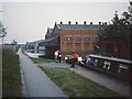
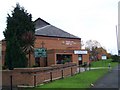
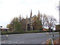
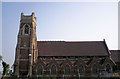
Photos of B11 1JU


Area Information
Living in B11 1JU means being part of a densely populated, culturally rich area within Birmingham’s Sparkbrook and Balsall Heath East ward. With a population of 1,655, this small postcode cluster is a microcosm of the city’s diversity, shaped by post-1960s migration from the Commonwealth. The area’s history as an industrial hub has left a legacy of community resilience, with a strong presence of small businesses along Stratford Road and Ladypool Road. While it is the most deprived ward in Birmingham, with the 8th highest child poverty rate, residents exhibit a dynamic spirit, balancing economic challenges with vibrant cultural life. The urban environment is characterised by flats, reflecting a rental-focused market, and a younger demographic with a median age of 22. Despite limited green spaces, Balsall Heath Park offers a local focal point. Daily life here is defined by proximity to retail, transport hubs, and a mix of schools, though the area’s economic struggles persist. For those seeking a culturally diverse, fast-paced urban lifestyle, B11 1JU offers both opportunities and challenges.
- Area Type
- Postcode
- Area Size
- Not available
- Population
- 1655
- Population Density
- 4932 people/km²
The property market in B11 1JU is overwhelmingly rental-focused, with only 18% of homes owned by residents. Flats dominate the housing stock, reflecting the area’s urban density and historical development patterns. This suggests limited opportunities for owner-occupation, particularly for first-time buyers seeking equity growth. The small postcode area’s property options are constrained by its size and the prevalence of multi-let buildings. While this may appeal to renters, buyers should consider the broader Birmingham context, where nearby areas might offer more varied housing stock. The low home ownership rate and flat-centric market indicate a reliance on private landlords, which can affect long-term stability for residents. For those prioritising property investment, B11 1JU may not be ideal, but its proximity to transport links and retail hubs could offset its limitations for those seeking affordability in a high-demand city.
House Prices in B11 1JU
No properties found in this postcode.
Energy Efficiency in B11 1JU
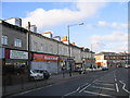
Residents of B11 1JU have access to a range of amenities within practical reach. Retail options include Spar City, Aldi Sparkbrook, and Iceland Birmingham, catering to everyday shopping needs. Nearby rail and metro stations—Bordesley, Small Heath, Birmingham Moor Street, Grand Central New Street, Corporation Street, and Bull Street—provide connectivity to Birmingham’s broader network. While the area’s economy is driven by small businesses along Stratford Road and Ladypool Road, these streets also reflect the community’s entrepreneurial spirit. Balsall Heath Park offers a green space for leisure, though specific recreational facilities are not detailed. The mix of retail, transport, and local commerce contributes to a convenient, if modest, lifestyle. However, the area’s challenges in economic investment may limit the growth of larger amenities, making it essential for residents to rely on nearby hubs for more extensive services.
Amenities
Schools
The schools near B11 1JU include St Anne’s Catholic Primary School (primary, Ofsted rating: good), The Harper Bell Adventist School (independent), Calthorpe School Sports College (special), Harper Bell Seventh-day Adventist School (primary, Ofsted rating: inadequate), and Calthorpe Academy (special). This mix of school types offers options for families, from state-funded primary and special needs education to independent institutions. However, the presence of a school with an inadequate Ofsted rating raises concerns about educational quality in some areas. The ward’s diversity is reflected in its schools, which cater to a range of needs, though families seeking high-performing state schools may need to look beyond the immediate area. The availability of special schools like Calthorpe School Sports College and Calthorpe Academy highlights the community’s commitment to inclusive education, though resources and outcomes vary across institutions.
| Rank | School | Type | Entry gender | Ages |
|---|
Explore more schools in this area
Go to Schools tabDemographics
B11 1JU has a median age of 22, though the most common age range is 30–64 years, indicating a working-age population. Home ownership is low at 18%, with flats being the predominant accommodation type. The area’s demographic profile is marked by a significant Black, Asian, and Minority Ethnic (BAME) population, reflecting its historical role as a migrant settlement. This diversity shapes the community’s character, with a younger age profile than Birmingham as a whole. However, the ward’s deprivation levels are stark: it is the city’s most deprived area, with the 8th highest child poverty rate. This impacts quality of life, with limited access to high-income employment and underinvestment in public services. Despite these challenges, the community’s entrepreneurial energy is evident in the thriving independent shops and street markets. The high BAME population share and young demographic suggest a dynamic, evolving social fabric, though residents face systemic barriers to economic mobility.
Household Size
Accommodation Type
Tenure
Ethnic Group
Religion
Household Composition
Age
Household Deprivation
NS-SEC
Explore more demographic insights in this area
Go to Demographics tabPlanning
Planning Constraints
- Flood RiskPremium
- Ramsar Wetland SitesPremium
- Area of Outstanding Natural BeautyPremium
- Protected Nature ReservePremium
- Protected WoodlandPremium