Area Overview for B11 1JD
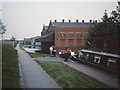
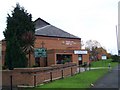
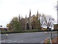
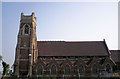
Photos of B11 1JD

Area Information
B11 1JD is a specific postcode area covering a small residential cluster within the Sparkbrook and Balsall Heath East ward of Birmingham. This inner-city location sits to the south-east of the city centre in the West Midlands, forming part of the Ward area known as Sparkbrook and Balsall Heath East. The ward was created in 2018 following boundary changes that expanded Birmingham's total wards to 69. It now accommodates 27,338 residents across a diverse urban landscape. The neighbourhoods trace an enriched history back to the industrial boom period of the late 19th century. Balsall Heath was officially incorporated into Birmingham in 1891. After the 1960s, the area became a significant economic and cultural hub for immigrant communities, particularly those arriving from the Commonwealth. This historical background continues to shape the daily life and character of the postcode today. The community remains well known for its international cultural richness. Residential life in this cluster is defined by a strong mix of cultures, a vibrant food scene, and active religious institutions that serve as central community assets. While the area faces challenges related to economic deprivation, the local population demonstrates significant entrepreneurial energy. Small businesses and independent shops continue to thrive along major thoroughfares like Stratford Road and Ladypool Road. Living in B11 1JD means being part of an urban environment where community spirit and cultural heritage drive the local atmosphere.
- Area Type
- Postcode
- Area Size
- Not available
- Population
- 1847
- Population Density
- 4738 people/km²
Homes in B11 1JD are defined primarily by the accommodation type data which specifies that houses are the standard dwelling structure. This suggests a traditional housing stock rather than a high-rise block development model. The home ownership rate stands at 29%, which indicates that the majority of residents operate within the private rental sector or secure tenure through other means. This high rental proportion often correlates with commuter locations near city centres or areas with significant student or professional transient populations. The 1847 resident figure for this specific postcode cluster is small compared to the wider 27,338 population of the Sparkbrook and Balsall Heath East ward. While the broader ward contains notable landmarks such as Balsall Heath Park, the immediate housing cluster focuses on individual property units. The low ownership percentage means fewer buyers are looking for owner-occupied investments compared to established family neighbourhoods with higher tenure rates. For those seeking to purchase homes in B11 1JD, the market is likely driven by people moving into tenanted properties or first-time buyers entering the market for the first time. The presence of houses as the predominant accommodation type offers a physical sensation of living in a semi-detached or detached environment rather than an apartment block. This distinction influences noise levels, garden privacy, and the general pace of daily life. Buyers should note that the local economy is driven by small businesses along Stratford Road and Ladypool Road, which may influence nearby rental yields if you plan to invest. The area represents a distinct segment of Birmingham's housing landscape where rental demand is a central reality for most households.
House Prices in B11 1JD
Showing 1 properties
| Address | Type | Beds | Baths | Last Sale Price | Last Sale Date | |
|---|---|---|---|---|---|---|
| Action House, Henley Street, Birmingham, B11 1JD | shop | - | - | - | - |
Energy Efficiency in B11 1JD
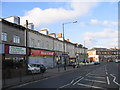
Daily life in B11 1JD offers convenient access to several key amenities within practical reach of the residential cluster. Retail options are well developed with five main shops identified nearby. Notable supermarkets include Spar City, Aldi Sparkbrook, and Iceland Birmingham, providing essential groceries and daily essentials without needing to travel far. For those who prefer rapid urban access, rail connections are available at five nearby stations. Bordesley Railway Station, Small Heath Railway Station, and Birmingham Moor Street Railway Station provide gateways to the wider network. Additionally, five metro stops serve the area directly including Corporation Street, Grand Central New Street, and Bull Street. These transport hubs are critical for commuters travelling to Birmingham's business districts or outside locations. The presence of these transport links brings major shopping centres and office parks into a short commute. While the immediate neighbourhood drives its own economy through standalone businesses on streets like Stratford Road, the proximity to Spar City and Aldi Sparkbrook offers consolidated shopping trips. The strategic location means residents can choose between local independent stores which thrive on community spirit or the convenience of large superstores. Transport choices extend to five distinct railway termini, ensuring flexibility whether you travel one stop or travel across the region. This blend of local retail and major transport nodes defines the practical lifestyle experience for people living here.
Amenities
Schools
Families looking at B11 1JD have access to a specific range of educational institutions with varying specialisations and regulatory ratings. Christ Church CofE Controlled Primary School and Nursery operates as a state-funded primary school. It holds an outstanding Ofsted rating, indicating high standards in education and performance. For children with special educational needs, R.Y.A.N Education Academy is available as a special needs school. This institution carries a good Ofsted rating, highlighting its commitment to providing specific learning support safely. There is also an independent option in the area: Camp Hill Education. This private school currently holds a satisfactory Ofsted rating, which meets legal requirements but suggests room for improvement compared to the state sector options. The mix of state, special needs, and independent provision offers different educational pathways for residents. Parents in B11 1JD can choose between a primary education with top-tier regulatory recognition or a more specialised curriculum for those requiring additional support. The presence of these schools within practical reach ensures that families do not need to commute far for their children's daily lessons. Educational choices in this postcode are limited to these three specific providers. The outstanding rating of Christ Church CofE Controlled Primary School and Nursery makes it a standout feature for parents seeking the highest standard of state education nearby. The special provision at R.Y.A.N Education Academy ensures that specific learning requirements are met without leaving the local vicinity.
| Rank | School | Type | Entry gender | Ages |
|---|
Explore more schools in this area
Go to Schools tabDemographics
The community within postcode B11 1JD reflects the wider profile of the Sparkbrook and Balsall Heath East ward. The population median age is 47 years, with adults aged between 30 and 64 years forming the most common age range. A Census overview for the 2011 period indicated an older average age than many other Birmingham areas, suggesting a stable, established population. Despite some declining birth rates, the ward remains highly diverse. It has the highest ethnic diversity of any ward in the city. The predominant ethnic group in the area is Asian, a demographic trend that is reflected in the local architecture, food markets, and everyday interactions. About 29% of households in the vicinity are owner-occupied, meaning the majority of residents rent their homes. Houses make up the primary form of accommodation in this cluster. The area also holds the distinction of being the second most populous ward in Birmingham, with a total of 27,338 residents. Economic data shows the ward has a Gross Value Added of £368 million. This represents a GVA per head of £14,341, which ranks it as the 17th largest economy among the city's 69 wards. The area is characterised as the city's most deprived ward and contains the 8th highest child poverty rate out of all wards in Birmingham. These statistics indicate specific pressures on local quality of life and public services. Nonetheless, the community maintains a strong social fabric driven by the cultural energy of its residents.
Household Size
Accommodation Type
Tenure
Ethnic Group
Religion
Household Composition
Age
Household Deprivation
NS-SEC
Explore more demographic insights in this area
Go to Demographics tabPlanning
Planning Constraints
- Flood RiskPremium
- Ramsar Wetland SitesPremium
- Area of Outstanding Natural BeautyPremium
- Protected Nature ReservePremium
- Protected WoodlandPremium