Area Overview for B11 1HL
Photos of B11 1HL
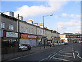

100 photos from this area
Area Information
Key information about the B11 1HL including its size, population, and administrative classification.
- Area Type
- Postcode
- Area Size
- 2.0 hectares
- Population
- 1847
- Population Density
- 4738 people/km²
House Prices in B11 1HL
34
Properties
£120,250
Average Sold Price
£30,000
Lowest Price
£250,000
Highest Price
Showing 34 properties
| Address | Type | Beds | Baths | Last Sale Price | Last Sale Date | |
|---|---|---|---|---|---|---|
| 35 Dolobran Road, Birmingham, B11 1HL | Terraced | 3 | 2 | £250,000 | Jan 2024 | |
| 41 Dolobran Road, Birmingham, B11 1HL | Terraced | 4 | 1 | £175,000 | Nov 2018 | |
| 45 Dolobran Road, Birmingham, B11 1HL | Terraced | 4 | 1 | £165,500 | Oct 2018 | |
| 73 Dolobran Road, Birmingham, B11 1HL | Semi-detached | - | - | £140,000 | Oct 2017 | |
| 51 Dolobran Road, Birmingham, B11 1HL | Terraced | 2 | 2 | £125,000 | Mar 2016 | |
| 65 Dolobran Road, Birmingham, B11 1HL | Maisonette | 1 | - | £46,500 | Mar 2011 | |
| 71 Dolobran Road, Birmingham, B11 1HL | house | - | - | £131,000 | Apr 2003 | |
| 57 Dolobran Road, Birmingham, B11 1HL | Terraced | 2 | 1 | £59,500 | Aug 2002 | |
| 81 Dolobran Road, Birmingham, B11 1HL | Terraced | - | - | £80,000 | Dec 2001 | |
| 83 Dolobran Road, Birmingham, B11 1HL | Terraced | - | - | £30,000 | Mar 1997 |
Page 1 of 4
Energy Efficiency in B11 1HL
Amenities
Schools
| Rank | School | Type | Entry gender | Ages |
|---|
Explore more schools in this area
Go to Schools tabDemographics
Household Size
One person
most common
Accommodation Type
Houses
most common
Tenure
29
majority
Ethnic Group
asian_total
most common
Religion
N/A
most common
Household Composition
N/A
most common
Age
47
median
Adults (30-64 years)
most common
Household Deprivation
N/A
with no deprivation
NS-SEC
9
in Lower managerial occupations
Explore more demographic insights in this area
Go to Demographics tabPlanning
Planning Constraints
- Flood RiskPremium
- Ramsar Wetland SitesPremium
- Area of Outstanding Natural BeautyPremium
- Protected Nature ReservePremium
- Protected WoodlandPremium