Area Overview for B11 1BD
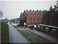
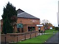
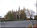
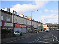
Photos of B11 1BD


Area Information
Living in B11 1BD means being part of a small, densely populated postcode area within the Sparkbrook and Balsall Heath East ward of Birmingham. With 1,779 residents, this urban cluster is defined by its cultural diversity and historical significance as a hub for immigrant communities since the 1960s. The area’s character is shaped by its younger demographic—median age 22—with a strong presence of Asian communities. Daily life here is marked by a mix of small businesses and independent shops along Stratford Road and Ladypool Road, offering a vibrant local economy. Despite challenges like high deprivation and unemployment, the ward’s residents exhibit entrepreneurial energy. Proximity to Balsall Heath Park provides a green space for recreation, while nearby rail and metro stations ensure connectivity to Birmingham’s core. However, the area’s most deprived status in the city highlights ongoing socioeconomic challenges, though its rich cultural tapestry and community spirit remain defining features for those considering homes in B11 1BD.
- Area Type
- Postcode
- Area Size
- Not available
- Population
- 1779
- Population Density
- 3006 people/km²
The property market in B11 1BD reflects a low home ownership rate, with only 39% of residents owning their homes. This suggests a rental-dominated market, where houses are the primary accommodation type. Given the area’s small size and limited housing stock, competition for available properties is likely to be high, particularly for owner-occupiers. The predominance of houses over flats or apartments may appeal to families seeking space, though the lack of detailed data on property prices or development trends means buyers must consider the ward’s broader socioeconomic context. The high deprivation level and limited economic investment could impact long-term property value growth, but the area’s cultural diversity and proximity to transport links may attract buyers seeking affordability within Birmingham’s urban core. For those considering homes in B11 1BD, the market’s dynamics underscore the need to balance location advantages with the area’s practical challenges.
House Prices in B11 1BD
No properties found in this postcode.
Energy Efficiency in B11 1BD
Residents of B11 1BD enjoy access to a range of amenities within practical reach. The area’s retail sector includes Spar City, Aldi Sparkbrook, and Iceland Birmingham, offering everyday shopping convenience. Nearby rail and metro stations provide swift access to Birmingham’s central business districts and beyond. Balsall Heath Park, located within the ward, offers green space for leisure and outdoor activities, contributing to a balanced lifestyle. The character of daily life is further enriched by the presence of independent shops and small businesses along Stratford Road and Ladypool Road, which foster a sense of community. While the area’s economic challenges may limit high-end amenities, the combination of practical retail, transport links, and accessible green space ensures a functional and connected lifestyle for residents.
Amenities
Schools
Residents of B11 1BD have access to three notable schools within proximity. Holy Trinity Catholic School serves as both a primary and academy school, both with Ofsted ratings of “good.” Hazrat Khadijatul Kubra Girls School is an independent institution also rated “good” by Ofsted. This mix of state-funded and independent schools offers families flexibility, whether they seek affordable public education or specialist private options. The presence of two schools with strong ratings suggests a commitment to quality education in the area, though the limited number of institutions may require families to consider commuting for broader choices. For homebuyers prioritising schools, the availability of these options is a key consideration, particularly given the ward’s younger population and focus on family-oriented living.
| Rank | School | Type | Entry gender | Ages |
|---|
Explore more schools in this area
Go to Schools tabDemographics
The community in B11 1BD is predominantly young, with a median age of 22 and the most common age range being adults aged 30–64. Only 39% of residents own their homes, with houses being the primary accommodation type. The area’s demographic profile is heavily influenced by its Asian_total population, which forms the predominant ethnic group. This diversity is reflected in the ward’s cultural vibrancy, though it also faces significant deprivation. As Birmingham’s most deprived ward, B11 1BD has the 8th highest child poverty rate among the city’s 69 wards. This context affects quality of life, with limited economic opportunities and higher unemployment rates compared to the city average. Despite these challenges, the area’s younger population and high BAME (Black, Asian, and Minority Ethnic) share contribute to a dynamic, community-driven environment. For homebuyers, understanding these demographics is crucial to assessing both the area’s character and its practical realities.
Household Size
Accommodation Type
Tenure
Ethnic Group
Religion
Household Composition
Age
Household Deprivation
NS-SEC
Explore more demographic insights in this area
Go to Demographics tabPlanning
Planning Constraints
- Flood RiskPremium
- Ramsar Wetland SitesPremium
- Area of Outstanding Natural BeautyPremium
- Protected Nature ReservePremium
- Protected WoodlandPremium