Area Overview for B11 1AW
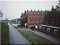
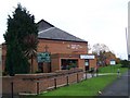
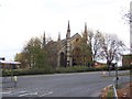
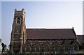
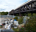
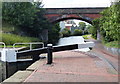
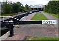
Photos of B11 1AW

Area Information
Living in B11 1AW, part of Sparkbrook and Balsall Heath East in Birmingham, means being part of a densely populated, culturally rich urban area. With a population of 1,847 in this small postcode cluster, the community reflects Birmingham’s broader diversity, dominated by Asian communities. The area’s history as a hub for post-1960s Commonwealth migrants has left a legacy of vibrant food culture, independent shops, and community-driven initiatives. However, it is also Birmingham’s most deprived ward, with high child poverty rates and economic challenges. Despite this, the area thrives on entrepreneurial energy, with small businesses along Stratford Road and Ladypool Road. Residents benefit from proximity to Balsall Heath Park, though transport options are limited to nearby rail and metro links. Daily life here balances urban convenience with the pressures of deprivation, making it a complex but dynamic place to live.
- Area Type
- Postcode
- Area Size
- Not available
- Population
- 1847
- Population Density
- 4738 people/km²
The property market in B11 1AW is defined by a low home ownership rate (29%) and a predominance of houses. This suggests a rental market with limited owner-occupied properties, likely due to the area’s economic challenges and high deprivation levels. The presence of houses rather than flats indicates a focus on traditional housing stock, which may appeal to families seeking space but could limit availability for first-time buyers. Given the small postcode area, property choices are likely constrained, with limited scope for development due to planning constraints. Buyers should consider the area’s affordability against its social and economic challenges, as well as the need for enhanced security measures given the high crime risk.
House Prices in B11 1AW
No properties found in this postcode.
Energy Efficiency in B11 1AW
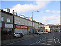
Residents of B11 1AW have access to essential amenities within practical reach. Retail options include Spar City, Aldi Sparkbrook, and Iceland Birmingham, offering everyday shopping convenience. Nearby rail stations and metro stops, such as Grand Central New Street and Corporation Street, facilitate travel to Birmingham’s central areas. Balsall Heath Park provides a green space for leisure and exercise, though specific landmarks beyond this are not detailed in the data. The area’s character is defined by small businesses along Stratford Road and Ladypool Road, contributing to a localised commercial vibe. While the lack of major transport hubs and detailed infrastructure data may limit broader connectivity, the proximity to retail and public transport supports a functional, if modest, lifestyle.
Amenities
Schools
Residents of B11 1AW have access to a range of school types, though ratings vary. Christ Church CofE Controlled Primary School and Nursery is a primary school with an outstanding Ofsted rating, offering high-quality early education. R.Y.A.N Education Academy, a special school, holds a good rating, catering to students with specific needs. Camp Hill Education, an independent school, has a satisfactory rating. This mix provides options for families, from state-funded primary education to specialist and private institutions. However, the presence of a special school and the absence of high-performing independent schools may influence choices for those prioritising academic excellence. Parents should consider the varying Ofsted ratings when evaluating educational opportunities for their children.
| Rank | School | Type | Entry gender | Ages |
|---|
Explore more schools in this area
Go to Schools tabDemographics
The population of B11 1AW has a median age of 47, with the majority of residents aged 30–64. Only 29% of households are owner-occupied, reflecting a community where rental housing dominates. The area is characterised by a high proportion of houses, contrasting with higher-density urban zones. The predominant ethnic group is Asian, contributing to the area’s cultural diversity. However, this diversity coexists with significant deprivation: the ward has the 8th highest child poverty rate in Birmingham and faces challenges in health and economic outcomes. These factors influence quality of life, with residents often relying on community networks and local amenities to mitigate systemic underinvestment. The younger age profile compared to the city as a whole suggests a mix of long-term residents and newer arrivals, though employment rates remain below the city average.
Household Size
Accommodation Type
Tenure
Ethnic Group
Religion
Household Composition
Age
Household Deprivation
NS-SEC
Explore more demographic insights in this area
Go to Demographics tabPlanning
Planning Constraints
- Flood RiskPremium
- Ramsar Wetland SitesPremium
- Area of Outstanding Natural BeautyPremium
- Protected Nature ReservePremium
- Protected WoodlandPremium