Area Overview for B11 1AH
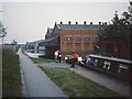
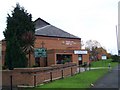
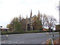
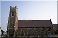
Photos of B11 1AH

Area Information
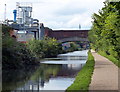
Living in B11 1AH means being part of Sparkbrook and Balsall Heath East, a small postcode area in Birmingham’s inner city. This ward, created in 2018, covers urban Sparkbrook and parts of Balsall Heath, home to 27,338 residents across its broader electoral area. The population here is 1,791, reflecting its compact size. The area’s character is defined by its cultural diversity, shaped by post-1960s migration from the Commonwealth. Despite being Birmingham’s most deprived ward, with the 8th highest child poverty rate, it thrives on community spirit and independent businesses along Stratford Road and Ladypool Road. Daily life blends urban convenience with pockets of entrepreneurial energy, though challenges like economic deprivation and health inequalities persist. Balsall Heath Park offers a green space for residents, while nearby retail hubs and transport links provide practical connectivity. For buyers, B11 1AH represents a mix of opportunity and complexity, where cultural richness coexists with pressing social needs.
- Area Type
- Postcode
- Area Size
- Not available
- Population
- 1791
- Population Density
- 4924 people/km²
B11 1AH’s property market is characterised by a 45% home ownership rate, suggesting a balance between owner-occupied homes and rental properties. The accommodation type is primarily houses, which is unusual for inner-city areas, indicating a mix of older, family-friendly housing stock and newer developments. This predominance of houses may appeal to buyers seeking more space than typical city flats, but the small area’s limited size means housing options are constrained. The market likely includes both long-term residents and investors, given the ward’s proximity to transport links and amenities. However, the area’s deprivation status may affect property values and investment potential, with buyers needing to weigh the cultural vibrancy against economic challenges. For those prioritising space and community, B11 1AH offers a distinct proposition within Birmingham’s urban landscape.
House Prices in B11 1AH
No properties found in this postcode.
Energy Efficiency in B11 1AH
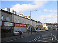
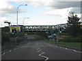
Life in B11 1AH includes access to nearby retail amenities such as Spar City, Aldi Sparkbrook, and Lidl Sparkbrook, offering everyday shopping convenience. The area’s railway stations—Bordesley, Small Heath, and Birmingham Moor Street—provide links to Birmingham’s transport network, while metro stops like Corporation Street and Bull Street enhance urban mobility. Balsall Heath Park, a local landmark, offers green space for recreation. The ward’s commercial hubs, particularly Stratford Road and Ladypool Road, host independent shops and eateries, contributing to a distinct urban character. While the area’s deprivation status may limit high-end amenities, the proximity to retail, transport, and community spaces creates a practical lifestyle for residents.
Amenities
Schools
B11 1AH is served by a range of educational institutions, including Joseph Chamberlain Sixth Form College, a sixth-form college offering post-16 education. Nearby independent schools include Redstone Academy for Boys and Redstone Academy for Girls, both rated ‘good’ by Ofsted, and Heritage Academy, rated ‘outstanding’. This mix of school types provides families with options from state-funded sixth-form provision to independent education with high standards. The presence of multiple schools in the area suggests a focus on education, though the ward’s deprivation levels may influence school resources and student outcomes. Parents seeking high-quality education for their children will find a variety of choices, though the broader economic context should be considered when evaluating long-term prospects.
| Rank | School | Type | Entry gender | Ages |
|---|
Explore more schools in this area
Go to Schools tabDemographics
The median age in B11 1AH is 47, with the most common age range being adults aged 30–64. Home ownership stands at 45%, slightly below the national average, and the area is predominantly composed of houses rather than flats or apartments. The predominant ethnic group is Asian_total, reflecting the ward’s legacy as a hub for Commonwealth migrants. This demographic profile contributes to a community with a strong sense of cultural identity, though it also faces systemic challenges. The ward’s high deprivation levels—ranked 1st in Birmingham—translate to limited access to high-quality services and higher unemployment rates. Child poverty here is the 8th highest in the city, impacting family stability and educational outcomes. Despite these issues, the area’s residents, many of whom are working-age adults, maintain a resilient community fabric, with small businesses and faith-based organisations serving as anchors.
Household Size
Accommodation Type
Tenure
Ethnic Group
Religion
Household Composition
Age
Household Deprivation
NS-SEC
Explore more demographic insights in this area
Go to Demographics tabPlanning
Planning Constraints
- Flood RiskPremium
- Ramsar Wetland SitesPremium
- Area of Outstanding Natural BeautyPremium
- Protected Nature ReservePremium
- Protected WoodlandPremium