Area Overview for B10 9RD
Photos of B10 9RD
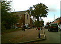
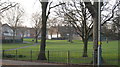

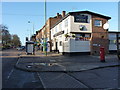
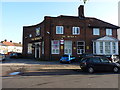
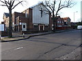
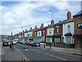
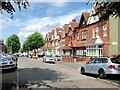
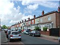
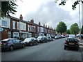
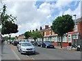
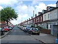
24 photos from this area
Area Information
Key information about the B10 9RD including its size, population, and administrative classification.
- Area Type
- Postcode
- Area Size
- 2.0 hectares
- Population
- 1837
- Population Density
- 12239 people/km²
House Prices in B10 9RD
81
Properties
£155,687
Average Sold Price
£25,000
Lowest Price
£341,000
Highest Price
Showing 81 properties
| Address | Type | Beds | Baths | Last Sale Price | Last Sale Date | |
|---|---|---|---|---|---|---|
| 66 Dora Road, Bordesley Green, Birmingham, B10 9RD | house | - | - | £123,573 | May 2025 | |
| 62 Dora Road, Bordesley Green, Birmingham, B10 9RD | Terraced | 4 | 2 | £341,000 | Apr 2025 | |
| 32 Dora Road, Bordesley Green, Birmingham, B10 9RD | house | - | - | £225,000 | Feb 2024 | |
| 72 Dora Road, Bordesley Green, Birmingham, B10 9RD | Terraced | 4 | 1 | £270,000 | Jun 2023 | |
| 58 Dora Road, Bordesley Green, Birmingham, B10 9RD | Terraced | 5 | 2 | £235,000 | Dec 2016 | |
| 70 Dora Road, Bordesley Green, Birmingham, B10 9RD | Terraced | 4 | 2 | £204,000 | Mar 2016 | |
| 44 Dora Road, Bordesley Green, Birmingham, B10 9RD | house | - | - | £80,000 | Dec 2011 | |
| 88 Dora Road, Bordesley Green, Birmingham, B10 9RD | house | - | - | £172,000 | Sep 2011 | |
| 82 Dora Road, Bordesley Green, Birmingham, B10 9RD | house | - | - | £225,000 | Jan 2011 | |
| 4 Dora Road, Bordesley Green, Birmingham, B10 9RD | house | - | - | £90,972 | Sep 2007 |
Page 1 of 9
Energy Efficiency in B10 9RD
Amenities
Schools
| Rank | School | Type | Entry gender | Ages |
|---|
Explore more schools in this area
Go to Schools tabDemographics
Household Size
Family (3-5 people)
most common
Accommodation Type
Houses
most common
Tenure
63
majority
Ethnic Group
asian_total
most common
Religion
N/A
most common
Household Composition
N/A
most common
Age
47
median
Adults (30-64 years)
most common
Household Deprivation
N/A
with no deprivation
NS-SEC
15
in Lower managerial occupations
Explore more demographic insights in this area
Go to Demographics tabPlanning
Planning Constraints
- Flood RiskPremium
- Ramsar Wetland SitesPremium
- Area of Outstanding Natural BeautyPremium
- Protected Nature ReservePremium
- Protected WoodlandPremium