Area Overview for B10 9LQ
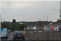
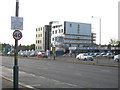
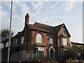
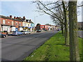
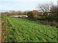
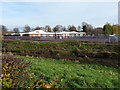
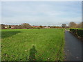
Photos of B10 9LQ


Area Information
B10 9LQ is a small residential cluster in Birmingham, England, with a population of 2110. Nestled in the historic Small Heath area, this postcode sits on a former heathland that was transformed into terraced housing from the 19th century. The area’s character is shaped by its Victorian origins and a diverse community, including significant Irish, Pakistani, Indian, and West Indian influences. Daily life here is defined by proximity to transport links, including rail and metro stations, and a mix of retail amenities. The postcode lies near the Warwick and Birmingham Canal, a historic waterway that once facilitated trade and now offers a quiet counterpoint to the urban environment. While the area is compact, it is well-connected to Birmingham’s broader infrastructure, with nearby business parks and cultural hubs. For buyers, B10 9LQ offers a blend of affordability and accessibility, though its small size means the housing stock is limited to a few hundred homes. The area’s low crime risk and strong broadband connectivity make it appealing for those seeking a balanced urban lifestyle without the pressures of larger cities.
- Area Type
- Postcode
- Area Size
- Not available
- Population
- 2110
- Population Density
- 4316 people/km²
The property market in B10 9LQ is dominated by houses, which is atypical for a small urban postcode. With 58% home ownership, the area leans toward owner-occupied properties rather than rental markets, though the limited number of homes (around 200) means the stock is not expansive. The prevalence of houses suggests a mix of older, larger homes built in the 19th century and some post-war developments. For buyers, this creates a niche market where properties are likely to be family homes with established gardens or ground-floor spaces. The compact nature of the area means that proximity to transport and amenities is a key selling point. However, the limited housing stock also means competition for available properties, particularly given the area’s strong broadband and low crime risk. Buyers should consider the small size of the postcode when exploring nearby options.
House Prices in B10 9LQ
No properties found in this postcode.
Energy Efficiency in B10 9LQ
The lifestyle in B10 9LQ is shaped by its proximity to retail, transport, and historical sites. Nearby shops include Iceland Heybarnes, Asda Small, and Lidl Yardley, offering convenience for daily essentials. The area’s rail and metro connections—Tyseley Railway Station, Small Heath Railway Station, and Adderley Park Railway Station—provide easy access to Birmingham’s cultural and commercial hubs. While the data does not mention parks or leisure facilities directly, the area’s history as a former heathland and its location near the Warwick and Birmingham Canal suggest opportunities for outdoor activities. The presence of multiple places of worship and historic churches, such as St Aidan and St Gregory the Great, adds to the area’s community character. Overall, B10 9LQ offers a compact, accessible lifestyle with a focus on connectivity and practical amenities.
Amenities
Schools
The nearest school to B10 9LQ is Eden Girls’ Leadership Academy in Birmingham, an academy with an outstanding Ofsted rating. This school serves the broader Small Heath area and is likely to be a primary or secondary institution, given its name and rating. The presence of a high-performing academy suggests that families in B10 9LQ have access to quality education, though no other schools are listed in the data. The mix of school types—only one is explicitly named—means that parents may need to look slightly beyond the immediate area for additional options. The academy’s status as an outstanding institution could be a significant draw for families prioritising educational quality, though the lack of other schools in the data implies limited local choice.
| Rank | School | Type | Entry gender | Ages |
|---|
Explore more schools in this area
Go to Schools tabDemographics
The median age in B10 9LQ is 22, with the most common age range being adults aged 30-64. This suggests a community that balances young families and working-age residents. Home ownership is high at 58%, indicating a stable population with long-term residency. The predominant accommodation type is houses, which is unusual for inner-city areas, hinting at a mix of older, larger properties. The predominant ethnic group is Asian, reflecting the area’s historical settlement patterns, including post-WWII migration from Pakistan, India, and the West Indies. This diversity influences local culture and community dynamics. While no deprivation data is provided, the high home ownership and low crime risk suggest a relatively stable socioeconomic profile. The presence of multiple places of worship, including St Aidan and St Gregory the Great churches, further underscores the area’s social cohesion.
Household Size
Accommodation Type
Tenure
Ethnic Group
Religion
Household Composition
Age
Household Deprivation
NS-SEC
Explore more demographic insights in this area
Go to Demographics tabPlanning
Planning Constraints
- Flood RiskPremium
- Ramsar Wetland SitesPremium
- Area of Outstanding Natural BeautyPremium
- Protected Nature ReservePremium
- Protected WoodlandPremium