Area Overview for B10 9LL
Photos of B10 9LL


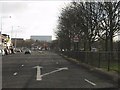
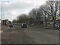
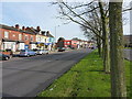
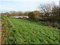
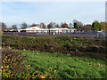
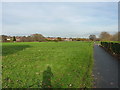
14 photos from this area
Area Information
Key information about the B10 9LL including its size, population, and administrative classification.
- Area Type
- Postcode
- Area Size
- 1.2 hectares
- Population
- 3378
- Population Density
- 14134 people/km²
House Prices in B10 9LL
36
Properties
£88,343
Average Sold Price
£30,000
Lowest Price
£175,000
Highest Price
Showing 36 properties
| Address | Type | Beds | Baths | Last Sale Price | Last Sale Date | |
|---|---|---|---|---|---|---|
| 300 Somerville Road, Bordesley Green, Birmingham, B10 9LL | Terraced | 3 | 1 | £100,000 | Jun 2023 | |
| 328 Somerville Road, Bordesley Green, Birmingham, B10 9LL | house | - | - | £175,000 | Aug 2022 | |
| 304 Somerville Road, Bordesley Green, Birmingham, B10 9LL | house | - | - | £140,000 | Feb 2020 | |
| 324 Somerville Road, Bordesley Green, Birmingham, B10 9LL | Terraced | 4 | 1 | £160,000 | Jul 2018 | |
| 354 Somerville Road, Bordesley Green, Birmingham, B10 9LL | Terraced | 2 | 1 | £94,500 | Dec 2013 | |
| 318 Somerville Road, Bordesley Green, Birmingham, B10 9LL | house | - | - | £95,000 | May 2011 | |
| 310 Somerville Road, Bordesley Green, Birmingham, B10 9LL | house | - | - | £130,000 | Mar 2007 | |
| 348 Somerville Road, Bordesley Green, Birmingham, B10 9LL | house | - | - | £108,000 | Jun 2006 | |
| 284 Somerville Road, Bordesley Green, Birmingham, B10 9LL | Terraced | - | - | £81,000 | Jan 2006 | |
| 332 Somerville Road, Bordesley Green, Birmingham, B10 9LL | house | - | - | £100,000 | Dec 2004 |
Page 1 of 4
Energy Efficiency in B10 9LL
Amenities
Schools
| Rank | School | Type | Entry gender | Ages |
|---|
Explore more schools in this area
Go to Schools tabDemographics
Household Size
Family (3-5 people)
most common
Accommodation Type
Houses
most common
Tenure
57
majority
Ethnic Group
asian_total
most common
Religion
N/A
most common
Household Composition
N/A
most common
Age
22
median
Adults (30-64 years)
most common
Household Deprivation
N/A
with no deprivation
NS-SEC
11
in Lower managerial occupations
Explore more demographic insights in this area
Go to Demographics tabPlanning
Planning Constraints
- Flood RiskPremium
- Ramsar Wetland SitesPremium
- Area of Outstanding Natural BeautyPremium
- Protected Nature ReservePremium
- Protected WoodlandPremium