Area Overview for B10 9EQ
Photos of B10 9EQ
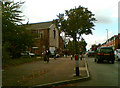
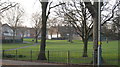
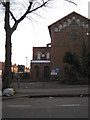
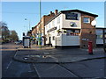
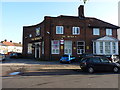
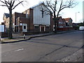
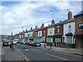
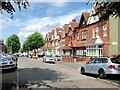
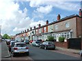
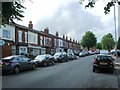
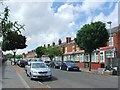
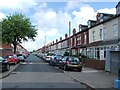
24 photos from this area
Area Information
Key information about the B10 9EQ including its size, population, and administrative classification.
- Area Type
- Postcode
- Area Size
- 3689 m²
- Population
- 2683
- Population Density
- 11545 people/km²
House Prices in B10 9EQ
16
Properties
£161,063
Average Sold Price
£59,000
Lowest Price
£300,000
Highest Price
Showing 16 properties
| Address | Type | Beds | Baths | Last Sale Price | Last Sale Date | |
|---|---|---|---|---|---|---|
| 217 Charles Road, Bordesley Green, Birmingham, B10 9EQ | Terraced | 3 | 2 | £265,000 | Mar 2023 | |
| 195 Charles Road, Bordesley Green, Birmingham, B10 9EQ | Retail | 5 | 1 | £300,000 | Feb 2022 | |
| 207 Charles Road, Bordesley Green, Birmingham, B10 9EQ | house | - | - | £165,000 | Nov 2021 | |
| 205 Charles Road, Bordesley Green, Birmingham, B10 9EQ | Terraced | 3 | 2 | £147,500 | Oct 2015 | |
| 197 Charles Road, Bordesley Green, Birmingham, B10 9EQ | house | - | - | £130,000 | May 2007 | |
| 203 Charles Road, Bordesley Green, Birmingham, B10 9EQ | house | - | - | £140,000 | Oct 2006 | |
| 219 Charles Road, Bordesley Green, Birmingham, B10 9EQ | house | - | - | £82,000 | Aug 2001 | |
| 215 Charles Road, Bordesley Green, Birmingham, B10 9EQ | Terraced | 3 | - | £59,000 | Feb 2001 | |
| 209 Charles Road, Bordesley Green, Birmingham, B10 9EQ | Terraced | - | - | - | - | |
| 223 Charles Road, Bordesley Green, Birmingham, B10 9EQ | Terraced | - | - | - | - |
Page 1 of 2
Energy Efficiency in B10 9EQ
Amenities
Schools
| Rank | School | Type | Entry gender | Ages |
|---|
Explore more schools in this area
Go to Schools tabDemographics
Household Size
Family (3-5 people)
most common
Accommodation Type
Houses
most common
Tenure
47
majority
Ethnic Group
asian_total
most common
Religion
N/A
most common
Household Composition
N/A
most common
Age
22
median
Adults (30-64 years)
most common
Household Deprivation
N/A
with no deprivation
NS-SEC
12
in Lower managerial occupations
Explore more demographic insights in this area
Go to Demographics tabPlanning
Planning Constraints
- Flood RiskPremium
- Ramsar Wetland SitesPremium
- Area of Outstanding Natural BeautyPremium
- Protected Nature ReservePremium
- Protected WoodlandPremium