Area Overview for B10 9DB
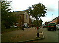
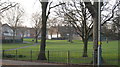
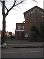
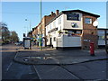
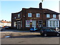
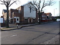
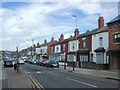
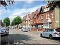
Photos of B10 9DB
Area Information
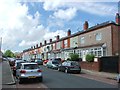
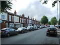
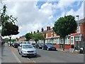
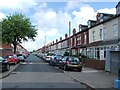
Living in B10 9DB means inhabiting a small, tightly knit residential cluster in Birmingham’s West Midlands, where history and modernity intersect. The area, once a heathland grazed by livestock, evolved into 19th-century terraced housing, shaped by industrial growth and migration. Today, it hosts 1,837 residents, predominantly adults aged 30–64, with a median age of 47. The community reflects its layered past: Victorian homes stand alongside a legacy of Irish, Pakistani, Indian, and West Indian immigrants, creating a culturally diverse fabric. Proximity to rail networks like Small Heath and Adderley Park stations, plus nearby metro stops, ensures easy access to Birmingham’s core. Retailers such as Asda Bordersley and Lidl Bordesley cater to daily needs. The area’s character is defined by its compact size, historic churches like St Aidan, and the former BSA factory site now repurposed as a business park. For buyers, B10 9DB offers a blend of traditional housing and urban connectivity, though its small footprint means proximity to surrounding areas is key.
- Area Type
- Postcode
- Area Size
- Not available
- Population
- 1837
- Population Density
- 12239 people/km²
The property market in B10 9DB is characterised by 63% home ownership, with houses dominating the housing stock. This suggests a predominantly owner-occupied area, though the small postcode area means buyers must consider nearby zones for broader options. The 19th-century terraced housing, developed during the Victorian era, reflects a mix of historic architecture and practical layouts suited to family living. The presence of the former BSA factory site, now a business park, hints at industrial heritage but does not directly impact residential properties. For buyers, this area offers a blend of traditional homes and proximity to transport hubs, though the limited size of B10 9DB itself means property choices are constrained. Those seeking larger estates or newer developments may need to look beyond immediate surroundings.
House Prices in B10 9DB
No properties found in this postcode.
Energy Efficiency in B10 9DB
Daily life in B10 9DB is shaped by its proximity to essential amenities. Retail options include Asda Small, Asda Bordersley, and Lidl Bordesley, offering groceries and household goods within easy reach. Rail stations like Small Heath and Adderley Park provide access to Birmingham’s wider transport network, while metro stops such as Bull Street and Grand Central New Street connect to central hubs. The area’s historic character is complemented by its practicality: terraced homes sit alongside former industrial sites now repurposed. Parks and open spaces are less explicitly detailed, but the legacy of heathland and 19th-century infrastructure suggests pockets of greenery. The presence of churches like St Aidan and St Gregory the Great adds to the area’s cultural texture, while the community’s diversity influences local restaurants and social hubs. This balance of heritage and accessibility makes B10 9DB a functional yet distinctive place to live.
Amenities
Schools
| Rank | School | Type | Entry gender | Ages |
|---|
Explore more schools in this area
Go to Schools tabDemographics
B10 9DB’s population of 1,837 is predominantly adults aged 30–64, reflecting a mature, stable community. Home ownership rates stand at 63%, with houses being the primary accommodation type, suggesting a mix of family homes and long-term residents. The area’s ethnic diversity is notable, with Asian communities forming the largest group, a legacy of post-WWII migration. This demographic profile shapes a community with established networks and cultural richness. While no specific deprivation data is provided, the high home ownership and presence of historic infrastructure suggest a relatively stable quality of life. The median age of 47 indicates a balance between active professionals and retirees, contributing to a cohesive social environment. However, the lack of younger households may influence local amenities and services.
Household Size
Accommodation Type
Tenure
Ethnic Group
Religion
Household Composition
Age
Household Deprivation
NS-SEC
Explore more demographic insights in this area
Go to Demographics tabPlanning
Planning Constraints
- Flood RiskPremium
- Ramsar Wetland SitesPremium
- Area of Outstanding Natural BeautyPremium
- Protected Nature ReservePremium
- Protected WoodlandPremium