Area Overview for B10 9AE
Photos of B10 9AE
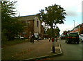
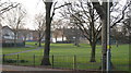
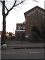
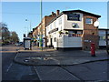
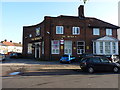
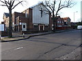
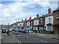
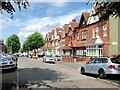
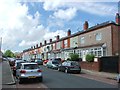
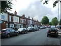
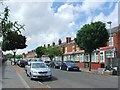
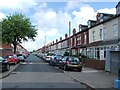
24 photos from this area
Area Information
Key information about the B10 9AE including its size, population, and administrative classification.
- Area Type
- Postcode
- Area Size
- 1.0 hectares
- Population
- 2419
- Population Density
- 18508 people/km²
House Prices in B10 9AE
40
Properties
£114,555
Average Sold Price
£44,000
Lowest Price
£182,000
Highest Price
Showing 40 properties
| Address | Type | Beds | Baths | Last Sale Price | Last Sale Date | |
|---|---|---|---|---|---|---|
| 99 Kenelm Road, Bordesley Green, Birmingham, B10 9AE | Terraced | 3 | - | £146,154 | Aug 2025 | |
| 165 Kenelm Road, Bordesley Green, Birmingham, B10 9AE | house | - | - | £182,000 | Jun 2021 | |
| 113 Kenelm Road, Bordesley Green, Birmingham, B10 9AE | house | - | - | £143,500 | Dec 2014 | |
| 137 Kenelm Road, Bordesley Green, Birmingham, B10 9AE | house | 3 | - | £131,000 | Sep 2014 | |
| 115 Kenelm Road, Bordesley Green, Birmingham, B10 9AE | house | - | - | £138,000 | Aug 2010 | |
| 141 Kenelm Road, Bordesley Green, Birmingham, B10 9AE | house | - | - | £150,000 | Apr 2008 | |
| 167 Kenelm Road, Bordesley Green, Birmingham, B10 9AE | Semi-detached | - | - | £144,000 | Dec 2004 | |
| 159 Kenelm Road, Bordesley Green, Birmingham, B10 9AE | house | - | - | £140,000 | Apr 2004 | |
| 157 Kenelm Road, Bordesley Green, Birmingham, B10 9AE | house | - | - | £48,000 | Aug 2001 | |
| 111 Kenelm Road, Bordesley Green, Birmingham, B10 9AE | Semi-detached | - | - | £53,000 | Sep 2000 |
Page 1 of 4
Energy Efficiency in B10 9AE
Amenities
Schools
| Rank | School | Type | Entry gender | Ages |
|---|
Explore more schools in this area
Go to Schools tabDemographics
Household Size
Family (3-5 people)
most common
Accommodation Type
Houses
most common
Tenure
73
majority
Ethnic Group
asian_total
most common
Religion
N/A
most common
Household Composition
N/A
most common
Age
22
median
Adults (30-64 years)
most common
Household Deprivation
N/A
with no deprivation
NS-SEC
11
in Lower managerial occupations
Explore more demographic insights in this area
Go to Demographics tabPlanning
Planning Constraints
- Flood RiskPremium
- Ramsar Wetland SitesPremium
- Area of Outstanding Natural BeautyPremium
- Protected Nature ReservePremium
- Protected WoodlandPremium