Area Overview for B10 0TZ
Photos of B10 0TZ
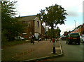


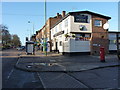
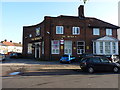
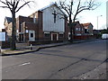
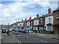
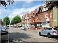
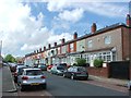
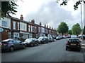
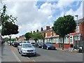
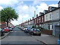
24 photos from this area
Area Information
Key information about the B10 0TZ including its size, population, and administrative classification.
- Area Type
- Postcode
- Area Size
- 1.1 hectares
- Population
- 1981
- Population Density
- 9146 people/km²
House Prices in B10 0TZ
32
Properties
£131,081
Average Sold Price
£51,000
Lowest Price
£307,000
Highest Price
Showing 32 properties
| Address | Type | Beds | Baths | Last Sale Price | Last Sale Date | |
|---|---|---|---|---|---|---|
| 856 Coventry Road, South Yardley, Birmingham, B10 0TZ | house | 6 | 6 | £307,000 | Feb 2024 | |
| 852 Coventry Road, South Yardley, Birmingham, B10 0TZ | house | - | - | £200,000 | Jun 2023 | |
| 880 Coventry Road, South Yardley, Birmingham, B10 0TZ | Terraced | 3 | 1 | £112,000 | Feb 2015 | |
| 858 Coventry Road, South Yardley, Birmingham, B10 0TZ | house | 3 | - | £138,500 | Mar 2014 | |
| 876 Coventry Road, South Yardley, Birmingham, B10 0TZ | house | - | - | £104,000 | Oct 2013 | |
| 862 Coventry Road, South Yardley, Birmingham, B10 0TZ | house | - | - | £100,000 | Sep 2013 | |
| 854 Coventry Road, South Yardley, Birmingham, B10 0TZ | house | - | - | £100,000 | Jun 2013 | |
| 828 Coventry Road, South Yardley, Birmingham, B10 0TZ | house | - | - | £70,000 | Oct 2008 | |
| 878 Coventry Road, South Yardley, Birmingham, B10 0TZ | Terraced | - | - | £150,000 | Mar 2008 | |
| 830 Coventry Road, South Yardley, Birmingham, B10 0TZ | house | - | - | £180,000 | Oct 2007 |
Page 1 of 4
Energy Efficiency in B10 0TZ
Amenities
Schools
| Rank | School | Type | Entry gender | Ages |
|---|
Explore more schools in this area
Go to Schools tabDemographics
Household Size
Family (3-5 people)
most common
Accommodation Type
Houses
most common
Tenure
65
majority
Ethnic Group
asian_total
most common
Religion
N/A
most common
Household Composition
N/A
most common
Age
22
median
Adults (30-64 years)
most common
Household Deprivation
N/A
with no deprivation
NS-SEC
11
in Lower managerial occupations
Explore more demographic insights in this area
Go to Demographics tabPlanning
Planning Constraints
- Flood RiskPremium
- Ramsar Wetland SitesPremium
- Area of Outstanding Natural BeautyPremium
- Protected Nature ReservePremium
- Protected WoodlandPremium