Area Overview for B10 0TB
Photos of B10 0TB
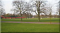
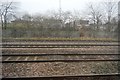
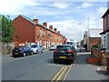
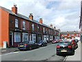
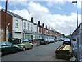
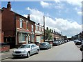
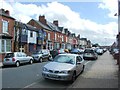
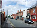
67 photos from this area
Area Information
Key information about the B10 0TB including its size, population, and administrative classification.
- Area Type
- Postcode
- Area Size
- 6921 m²
- Population
- 1854
- Population Density
- 17343 people/km²
House Prices in B10 0TB
34
Properties
£90,855
Average Sold Price
£22,500
Lowest Price
£157,000
Highest Price
Showing 34 properties
| Address | Type | Beds | Baths | Last Sale Price | Last Sale Date | |
|---|---|---|---|---|---|---|
| 56 Henshaw Road, Birmingham, B10 0TB | house | - | - | £157,000 | Jul 2022 | |
| 54 Henshaw Road, Birmingham, B10 0TB | house | 3 | 1 | £130,000 | Dec 2018 | |
| 38 Henshaw Road, Birmingham, B10 0TB | Terraced | - | - | £120,000 | Mar 2018 | |
| 6 Henshaw Road, Birmingham, B10 0TB | house | - | - | £120,000 | May 2015 | |
| 66 Henshaw Road, Birmingham, B10 0TB | house | - | - | £100,000 | Nov 2013 | |
| 34 Henshaw Road, Birmingham, B10 0TB | house | - | - | £87,000 | Aug 2010 | |
| 46 Henshaw Road, Birmingham, B10 0TB | house | - | - | £110,000 | Apr 2009 | |
| 20 Henshaw Road, Birmingham, B10 0TB | Terraced | 2 | 1 | £70,000 | Jun 2008 | |
| 24 Henshaw Road, Birmingham, B10 0TB | house | - | - | £89,000 | May 2008 | |
| 30 Henshaw Road, Birmingham, B10 0TB | house | - | - | £120,000 | May 2007 |
Page 1 of 4
Energy Efficiency in B10 0TB
Amenities
Schools
| Rank | School | Type | Entry gender | Ages |
|---|
Explore more schools in this area
Go to Schools tabDemographics
Household Size
Family (3-5 people)
most common
Accommodation Type
Houses
most common
Tenure
40
majority
Ethnic Group
asian_total
most common
Religion
N/A
most common
Household Composition
N/A
most common
Age
22
median
Adults (30-64 years)
most common
Household Deprivation
N/A
with no deprivation
NS-SEC
8
in Lower managerial occupations
Explore more demographic insights in this area
Go to Demographics tabPlanning
Planning Constraints
- Flood RiskPremium
- Ramsar Wetland SitesPremium
- Area of Outstanding Natural BeautyPremium
- Protected Nature ReservePremium
- Protected WoodlandPremium