Area Overview for B10 0SL
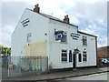
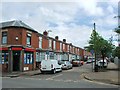
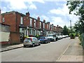
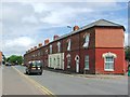
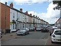
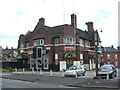
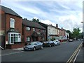
Photos of B10 0SL

Area Information
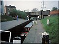
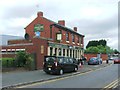
B10 0SL is a small residential postcode in Birmingham, England, centred around Bordesley Green, a historically significant area within the West Midlands. With a population of 1,899, it is a compact cluster of homes, predominantly houses, reflecting a community shaped by early 20th-century development. The area’s roots trace back to 1834, when housing began to expand east of Birmingham’s city centre, and it was further defined by the Ideal Village project between 1908 and 1914. This era left behind low-density housing, a park, and a school, which remain part of the area’s character. Today, B10 0SL is within walking distance of Birmingham’s mainline rail stations and key transport hubs, linking residents to the city’s economic and cultural heart. While flood risk is low, the area faces a critical crime risk, with safety scores indicating above-average crime rates. Despite this, the proximity to retail, education, and transport networks makes it a practical choice for those prioritising connectivity over rural tranquillity.
- Area Type
- Postcode
- Area Size
- Not available
- Population
- 1899
- Population Density
- 5465 people/km²
B10 0SL’s property market is defined by its 28% home ownership rate, which suggests a rental-heavy market. The area’s accommodation is predominantly houses, a rarity in inner-city Birmingham, indicating a legacy of early 20th-century housing developments like the Ideal Village. These homes, often with low-density layouts, may appeal to those seeking more space in a city setting. However, the small population and limited housing stock mean the market is likely constrained, with limited scope for new developments. Buyers should consider the area’s proximity to transport and amenities, which could offset the lower home ownership rate. The presence of independent schools and retail options nearby may also influence property values, though the high crime risk could deter some investors. For those prioritising rental yields, the mix of houses and community-focused infrastructure may present opportunities.
House Prices in B10 0SL
No properties found in this postcode.
Energy Efficiency in B10 0SL
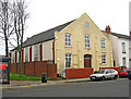
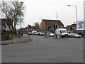
Daily life in B10 0SL is shaped by its proximity to retail, transport, and community spaces. The area’s retail offerings include Morrisons Bordesley, Iceland Birmingham, and Spar City, providing essential shopping options. The Ideal Village, developed in the early 20th century, retains its legacy with shops, a park, and a school, contributing to a sense of continuity. St Paul’s Church in Belchers Lane and Finnemore Road hosts community projects, adding to the area’s social fabric. Nearby rail and metro stations ensure easy access to Birmingham’s cultural and commercial hubs, while the absence of large green spaces means residents may need to travel for leisurely outdoor activities. The blend of historic infrastructure and modern connectivity creates a practical, if compact, living environment.
Amenities
Schools
B10 0SL is served by a range of schools, including Regents Park Community Primary School, which is a primary school with a good Ofsted rating. This provides a reliable option for younger families. Independent schools such as Eden School of Accountancy and Oakwood School (BIETTEC) cater to those seeking private education, while Green Heath School, another independent institution, also holds a good Ofsted rating. Blue River Academy, a special school, addresses specific educational needs. The mix of state and independent options offers flexibility, though the absence of secondary schools within the postcode means students may need to commute. The quality of primary education, particularly at Regents Park, is a notable advantage, but parents should assess the broader school network’s reach.
| Rank | School | Type | Entry gender | Ages |
|---|
Explore more schools in this area
Go to Schools tabDemographics
The population of B10 0SL is 1,899, with a median age of 47, indicating a mature community. The most common age range is adults aged 30–64, suggesting a stable demographic profile with fewer young families. Home ownership in the area is relatively low at 28%, implying that a significant portion of residents are likely to rent. The predominant accommodation type is houses, which is unusual for a city-centre postcode, hinting at a mix of older, family-oriented housing. The largest ethnic group is the Asian community, reflecting broader demographic trends in Birmingham. This composition influences the area’s cultural dynamics, with community projects like St Paul’s Church in Belchers Lane and Finnemore Road serving as focal points for local engagement. The absence of specific deprivation data means the quality of life is best inferred from the availability of amenities and transport links.
Household Size
Accommodation Type
Tenure
Ethnic Group
Religion
Household Composition
Age
Household Deprivation
NS-SEC
Explore more demographic insights in this area
Go to Demographics tabPlanning
Planning Constraints
- Flood RiskPremium
- Ramsar Wetland SitesPremium
- Area of Outstanding Natural BeautyPremium
- Protected Nature ReservePremium
- Protected WoodlandPremium