Area Overview for B10 0NS
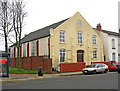
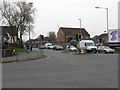
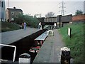
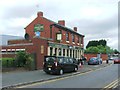
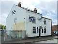
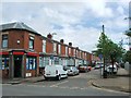
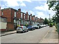
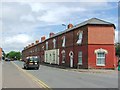
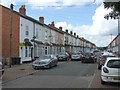
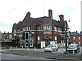
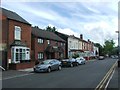
Photos of B10 0NS

Area Information
B10 0NS is a small residential postcode in Birmingham’s Bordesley Green area, home to 1,899 people. Situated two miles east of the city centre, it lies within a historically significant part of the West Midlands, marked by early 20th-century development and wartime history. The area’s character is defined by its mix of older housing stock and pockets of 1900s-era infrastructure, including the Ideal Village, a pioneering community designed for artisans. Daily life here is shaped by proximity to transport hubs and a range of local amenities, though the population remains relatively small. The area’s demographics reflect a mature community, with a median age of 47 and a strong presence of adults aged 30–64. While it lacks the density of Birmingham’s central districts, B10 0NS offers a quieter, more residential environment, with access to both independent and state education options. Its location near rail and metro lines ensures connectivity to the city’s core, making it a practical choice for commuters.
- Area Type
- Postcode
- Area Size
- Not available
- Population
- 1899
- Population Density
- 5465 people/km²
B10 0NS is a rental-focused area, with only 28% of residents owning their homes. This contrasts with the typical UK average, indicating a market where property is more likely to be let than bought. The accommodation type is predominantly houses, which is rare in urban settings, suggesting a niche appeal for those seeking single-family homes in a city context. This mix of rental availability and house-centric stock may limit buyer options, as the area’s small size and low population mean limited housing diversity. For buyers, the focus on houses could mean competition for larger properties, though the overall market is constrained by the postcode’s modest scale. The rental market’s dominance may also affect property values, with potential for appreciation tied to broader Birmingham trends rather than localized demand.
House Prices in B10 0NS
No properties found in this postcode.
Energy Efficiency in B10 0NS
Residents of B10 0NS have access to a range of local amenities within walking distance. Retail options include Morrisons Bordesley, Iceland Birmingham, and Spar City, providing essential shopping and grocery needs. The area’s rail and metro stations connect to Birmingham’s broader retail and leisure hubs. While parks are not explicitly mentioned in the data, historical references to the Ideal Village suggest the presence of green spaces and community facilities. The proximity to St Paul’s Church and its associated projects indicates a focus on local community engagement. The mix of retail, transport, and historical infrastructure creates a convenient, though compact, lifestyle. The area’s small size means amenities are concentrated, requiring minimal travel for daily needs but limiting access to larger-scale leisure or cultural venues.
Amenities
Schools
Residents of B10 0NS have access to a range of educational institutions. Regents Park Community Primary School is a state-funded primary school with a good Ofsted rating, offering a reliable option for younger children. Nearby, Eden School of Accountancy and Oakwood School (BIETTEC) are independent institutions, catering to those seeking private education. Green Heath School is another independent school with a good Ofsted rating, adding to the area’s diversity in schooling options. Blue River Academy is a special school, providing tailored support for specific needs. This mix of state, independent, and specialist schools ensures families can choose between public and private education, though the presence of only one primary school may require longer commutes for younger students. The quality ratings suggest a generally strong educational landscape, though availability of secondary schools is not specified.
| Rank | School | Type | Entry gender | Ages |
|---|
Explore more schools in this area
Go to Schools tabDemographics
The population of B10 0NS is 1,899, with a median age of 47, indicating a community skewed towards middle-aged adults. The most common age range is 30–64, suggesting a mix of working professionals and families. Home ownership is low at 28%, meaning the area is predominantly a rental market, likely attracting tenants rather than long-term homeowners. The accommodation type is primarily houses, which is unusual for urban areas, implying a focus on family homes. The predominant ethnic group is Asian, reflecting broader demographic trends in Birmingham. This diversity shapes the area’s social fabric but does not provide specific data on deprivation levels. The low home ownership rate may indicate economic or housing market pressures, though this is not explicitly quantified. The age profile suggests a stable, established community with limited presence of younger or older demographics.
Household Size
Accommodation Type
Tenure
Ethnic Group
Religion
Household Composition
Age
Household Deprivation
NS-SEC
Explore more demographic insights in this area
Go to Demographics tabPlanning
Planning Constraints
- Flood RiskPremium
- Ramsar Wetland SitesPremium
- Area of Outstanding Natural BeautyPremium
- Protected Nature ReservePremium
- Protected WoodlandPremium