Area Overview for B10 0LN
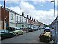
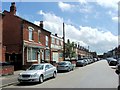
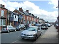
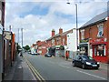
Photos of B10 0LN


Area Information
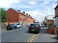
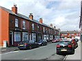
Living in B10 0LN, a small residential cluster in Birmingham’s Bordesley Green area, offers a blend of historical character and modern convenience. Situated about two miles east of the city centre, this postcode area is part of an inner-city ward with a population of 2,683. Its roots trace back to the 13th century, with urban development beginning in the 19th century. The Ideal Village, built between 1908 and 1914, remains a notable feature, featuring low-density housing, a park, and a school. Today, B10 0LN is a compact community with easy access to Birmingham’s cultural and economic hubs. While the median age is 22, the most common age range is 30–64, suggesting a mix of younger and middle-aged residents. The area’s proximity to rail stations, retail hubs, and the city’s transport network makes it appealing for commuters and families seeking a balance between urban and suburban living.
- Area Type
- Postcode
- Area Size
- Not available
- Population
- 2683
- Population Density
- 11545 people/km²
The property market in B10 0LN is defined by a 47% home ownership rate, with houses forming the primary accommodation type. This suggests a mix of owner-occupied and rental properties, though the relatively low home ownership figure indicates a significant proportion of the housing stock is rented. The predominance of houses over flats or apartments may appeal to families seeking space and privacy. However, as a small postcode area, the number of available properties is limited, meaning buyers may need to consider nearby zones. The market likely reflects broader trends in Birmingham’s inner-city areas, where housing demand is driven by proximity to transport links and employment opportunities. For buyers, the challenge lies in balancing availability with the area’s distinct character and amenities.
House Prices in B10 0LN
No properties found in this postcode.
Energy Efficiency in B10 0LN
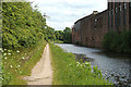
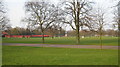
Residents of B10 0LN enjoy a range of amenities within walking or short driving distance. Retail options include major supermarkets like Morrisons, Iceland, and Asda, while rail and metro stations provide easy access to Birmingham’s transport network. The area’s historical character is preserved in features like the Ideal Village, which includes parks, shops, and community spaces. St Paul’s Church and its associated projects add to the local identity. The mix of practical amenities and historical sites creates a lifestyle that balances convenience with a sense of place. For daily life, the proximity to schools, retail, and transport ensures that essentials are accessible, while the area’s compact size fosters a close-knit community feel.
Amenities
Schools
Residents of B10 0LN have access to two notable schools. Somerville Primary (NC) School, a state-funded primary school with a Good Ofsted rating, provides education for younger children. Nearby is Darul Uloom Islamic High School, an independent institution also rated Good by Ofsted. The coexistence of a state primary and an independent high school offers families flexibility in educational choices. The presence of both school types suggests a community that values both public and private education. For parents, this diversity ensures options for different teaching approaches and curricula, though the proximity of these schools to the area is critical for families relying on local amenities.
| Rank | School | Type | Entry gender | Ages |
|---|
Explore more schools in this area
Go to Schools tabDemographics
B10 0LN has a median age of 22, though the most common age range is 30–64 years, indicating a population skewed toward adults. Home ownership stands at 47%, meaning nearly half of residents rent their homes. The accommodation type is predominantly houses, reflecting a residential character distinct from high-density housing areas. The predominant ethnic group is Asian, which shapes the area’s cultural and social fabric. This demographic profile suggests a community with established families and a strong sense of continuity. While deprivation data is not provided, the mix of age groups and ownership levels implies a diverse but tightly knit neighbourhood. The presence of both primary and independent schools further supports a family-oriented environment.
Household Size
Accommodation Type
Tenure
Ethnic Group
Religion
Household Composition
Age
Household Deprivation
NS-SEC
Explore more demographic insights in this area
Go to Demographics tabPlanning
Planning Constraints
- Flood RiskPremium
- Ramsar Wetland SitesPremium
- Area of Outstanding Natural BeautyPremium
- Protected Nature ReservePremium
- Protected WoodlandPremium