Area Overview for B10 0HW
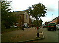
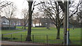
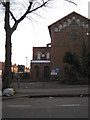
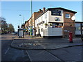
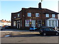
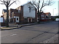
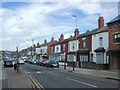
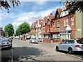
Photos of B10 0HW
Area Information
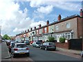
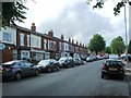
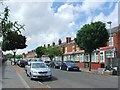
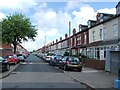
Living in B10 0HW means inhabiting a small, defined postcode area in Birmingham’s West Midlands, centred on a historic heathland transformed into a residential cluster. With a population of 1,807, this area is compact but rich in character, shaped by 19th-century terraced housing and a legacy of industrial activity. The community is predominantly adults aged 30–64, reflecting a mature demographic, though the median age of 22 suggests a younger presence, possibly linked to student or migrant populations. Daily life here is defined by proximity to transport networks, including railway and metro stations, and a mix of retail outlets. The area’s history as a grazing land and later a hub for manufacturing, such as the former Birmingham Small Arms factory, adds layers to its identity. While modern infrastructure like broadband with a perfect 100 score ensures connectivity, the area’s charm lies in its blend of urban convenience and historical roots, making it a practical choice for those seeking a balanced lifestyle in a city setting.
- Area Type
- Postcode
- Area Size
- Not available
- Population
- 1807
- Population Density
- 3769 people/km²
The property market in B10 0HW is characterised by a 46% home ownership rate, with houses being the dominant accommodation type. This suggests a mix of owner-occupied properties and rental units, though the exact proportion of rentals is not specified. The area’s housing stock consists largely of 19th-century terraced homes, many of which were built during the Victorian era for both wealthy residents and workers. These properties, while historically significant, may present challenges in terms of space and modernisation. For buyers, the compact nature of the postcode area means competition is likely limited to a small radius, with nearby developments potentially offering more options. The predominance of houses over flats also implies a focus on family living, though the relatively low home ownership rate could indicate a reliance on private rentals or shared housing.
House Prices in B10 0HW
No properties found in this postcode.
Energy Efficiency in B10 0HW
Residents of B10 0HW benefit from a range of nearby amenities, including retail outlets like Asda Small, Iceland Heybarnes, and Asda Bordersley, offering everyday shopping convenience. The area’s transport links, such as Small Heath Railway Station and the Corporation Street metro stop, provide easy access to Birmingham’s broader network. While specific parks or leisure facilities are not detailed in the data, the proximity to historic sites like the former BSA factory site and churches such as St Aidan and St Gregory the Great suggests a mix of cultural and historical interests. The presence of multiple retail and transport hubs indicates a lifestyle focused on practicality, with amenities designed to meet daily needs without requiring long commutes.
Amenities
Schools
Residents of B10 0HW have access to a range of schools, including Oldknow Junior School and Ark Chamberlain Primary Academy, both primary institutions. For secondary education, Ark Victoria Academy and The Olive School, Small Heath offer academy provision, with the latter holding an Ofsted rating of outstanding. Ark Victoria Academy is rated good by Ofsted. This mix of primary and academy schools provides families with options for both early and secondary education. The presence of a high-performing academy like The Olive School may attract families seeking quality education, while the primary schools cater to younger children. The proximity of these schools to the area underscores its appeal for families prioritising educational opportunities.
| Rank | School | Type | Entry gender | Ages |
|---|
Explore more schools in this area
Go to Schools tabDemographics
B10 0HW’s population of 1,807 is predominantly adults aged 30–64, with a median age of 22, suggesting a mix of working-age residents and younger individuals. Home ownership stands at 46%, with houses being the primary accommodation type, indicating a focus on family homes rather than flats. The predominant ethnic group is Asian_total, reflecting the area’s history of immigration, particularly from Pakistan, India, and the West Indies. This diversity shapes the community’s cultural fabric, though specific data on deprivation or income levels is not provided. The presence of 19th-century terraced housing, combined with a mature age demographic, suggests a stable, long-term resident base. However, the 46% home ownership rate implies a significant portion of the population may be renting, potentially influencing the local rental market and housing dynamics.
Household Size
Accommodation Type
Tenure
Ethnic Group
Religion
Household Composition
Age
Household Deprivation
NS-SEC
Explore more demographic insights in this area
Go to Demographics tabPlanning
Planning Constraints
- Flood RiskPremium
- Ramsar Wetland SitesPremium
- Area of Outstanding Natural BeautyPremium
- Protected Nature ReservePremium
- Protected WoodlandPremium