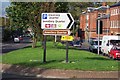
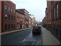
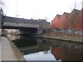
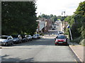
Area Overview for B1 2QJ
Photos of B1 2QJ


Area Information
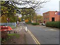
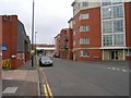
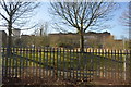
B1 2QJ is a small residential postcode in west Birmingham, nestled within the Ladywood Ward. This inner-city area, with a population of 1,107, sits near the heart of Birmingham’s administrative and historical core, including landmarks like the Council House and Town Hall. Historically, Ladywood was shaped by medieval woodlands and 19th-century industrial challenges, though much of its housing stock was rebuilt in the 20th century. Today, the area is a compact cluster of flats, reflecting its urban density. Residents here are predominantly adults aged 30–64, with a median age of 47. Daily life is defined by proximity to city amenities, rail networks, and a mix of retail and public services. While the area lacks natural landscapes, its strategic location near major transport hubs and city institutions offers convenience for commuters and those prioritising accessibility over green spaces. However, its history of social issues, including high crime rates, means residents must weigh the benefits of urban living against ongoing safety concerns.
- Area Type
- Postcode
- Area Size
- Not available
- Population
- 1107
- Population Density
- 6531 people/km²
The property market in B1 2QJ is characterised by a high proportion of flats, with no data indicating the presence of houses or other property types. Only 37% of residents own their homes, suggesting that the area is more rental-focused than owner-occupied. This dynamic may appeal to buyers seeking affordable, low-maintenance housing in a central location, though the limited home ownership rate implies competition for available properties. The concentration of flats also means that buyers should consider the practicalities of living in multi-unit buildings, such as shared amenities and potential noise from communal areas. Given the area’s proximity to Birmingham’s city centre, properties here may be attractive to professionals or students requiring easy access to transport and services. However, the high crime risk and lack of green spaces could deter those prioritising security and outdoor living.
House Prices in B1 2QJ
No properties found in this postcode.
Energy Efficiency in B1 2QJ
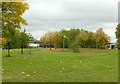
Life in B1 2QJ revolves around its proximity to retail, transport, and city-centre amenities. Nearby shops include Tesco Hockley, Spar, and Tesco Birmingham, offering everyday essentials within easy reach. The area’s rail network, with stations like Five Ways and Birmingham Snow Hill, and metro stops such as Edgbaston Village, provide seamless access to employment, leisure, and cultural hubs. While the data does not mention parks or leisure facilities, the area’s urban layout suggests a focus on convenience over open spaces. Residents can walk to the city’s landmarks, including the Council House, or use public transport to explore Birmingham’s wider attractions. The compact nature of the postcode means daily errands and social activities are efficiently managed, though those seeking extensive green spaces may need to venture beyond the immediate vicinity.
Amenities
Schools
The only school explicitly listed near B1 2QJ is Jewellery Quarter Academy, an academy with an Ofsted rating of “inadequate.” This rating indicates significant concerns about the quality of education, including teaching standards, student outcomes, and leadership. Families considering B1 2QJ must weigh the lack of high-performing schools against other factors, such as proximity to city amenities. The absence of additional schools in the data suggests limited educational options within the immediate area, potentially requiring parents to seek schools further afield. For families prioritising academic quality, this could be a critical consideration, though the area’s urban connectivity may ease access to alternative institutions.
| Rank | School | Type | Entry gender | Ages |
|---|---|---|---|---|
| 1 | Jewellery Quarter Academy | academy | N/A | N/A |
Explore more schools in this area
Go to Schools tabDemographics
The community in B1 2QJ is predominantly middle-aged, with a median age of 47 and 37% of residents owning their homes. The majority of the population falls within the 30–64 age range, suggesting a stable demographic of working-age adults. Accommodation is largely flat-based, reflecting the area’s post-war housing developments. The predominant ethnic group is White, though specific data on diversity is not provided. Home ownership is relatively low, with 37% of residents owning their properties, indicating a significant rental market. This statistic aligns with the area’s history of social housing and redevelopment. The age profile suggests a community focused on established careers and family life, though the lack of younger residents may limit local schools’ pupil demographics. The absence of detailed deprivation data means it is unclear how economic pressures affect quality of life, but the high crime risk noted in assessments could influence daily safety and well-being.
Household Size
Accommodation Type
Tenure
Ethnic Group
Religion
Household Composition
Age
Household Deprivation
NS-SEC
Explore more demographic insights in this area
Go to Demographics tabPlanning
Planning Constraints
- Flood RiskPremium
- Ramsar Wetland SitesPremium
- Area of Outstanding Natural BeautyPremium
- Protected Nature ReservePremium
- Protected WoodlandPremium
- Crime RiskPremium