Area Overview for B1 2EP
Photos of B1 2EP


Area Information
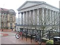
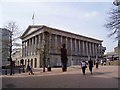
B1 2EP is a compact postcode area in west Birmingham, covering just 2.2 hectares and home to 1,126 residents. Its population density of 51,463 people per square kilometre reflects its status as a densely urbanised inner-city enclave. Situated within Ladywood Ward, this area has a complex history, once marked by poverty and redevelopment, but now positioned near key city landmarks like the Town Hall and Centenary Square. Daily life here is defined by proximity to Birmingham’s core, with residents enjoying easy access to rail, metro, and retail hubs. The area’s small size means it is tightly integrated with surrounding districts, creating a tightly woven community. While the median age of 47 suggests a mature population, the predominant age range of 30–64 years indicates a mix of established residents and families. The area’s compact nature and high connectivity make it a practical choice for those prioritising urban convenience over suburban sprawl.
- Area Type
- Postcode
- Area Size
- 2.2 hectares
- Population
- 1126
- Population Density
- 3617 people/km²
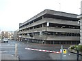
The property market in B1 2EP is characterised by a high proportion of rental properties, with only 24% of homes owned by residents. The accommodation type is overwhelmingly flats, a legacy of mid-20th-century housing policies that prioritised high-density living in urban areas. This makes the area unsuitable for buyers seeking detached homes or larger family properties. The small size of the postcode (2.2 hectares) means the housing stock is limited, and the immediate surroundings are likely to offer similar options. For buyers, this suggests a focus on flats in the rental market, though the high population density may lead to competition for available units. The area’s proximity to Birmingham’s city centre could be a draw for investors, but the lack of newer developments may limit long-term value growth.
House Prices in B1 2EP
No properties found in this postcode.
Energy Efficiency in B1 2EP
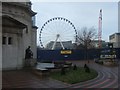
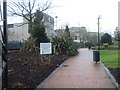
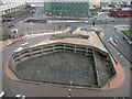
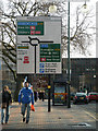
Life in B1 2EP is defined by its urban density and proximity to Birmingham’s core. Within practical reach are five metro stations, including Centenary Square and Town Hall, offering seamless access to the city’s business and cultural districts. Retail options include Sainsburys Brindley and Budgens Paradise, providing everyday shopping convenience. Rail connectivity is strong, with five stations offering links to Birmingham Snow Hill and Moor Street, facilitating travel across the West Midlands. While the area lacks parks or green spaces, its central location grants access to landmarks like the Council House and historical sites. The compact nature of B1 2EP means amenities are tightly clustered, though this can also lead to congestion. For those prioritising urban convenience over open space, the area’s mix of transport, retail, and cultural hubs offers a practical lifestyle.
Amenities
Schools
Near B1 2EP are two schools catering to different educational needs. Nelson Junior and Infant School is a primary school with a Good Ofsted rating, offering a solid foundation for young children. The Children’s Hospital School, a special needs institution, serves students with specific learning requirements, reflecting the area’s historical association with healthcare, including the former Birmingham Children’s Hospital. This combination of a mainstream primary school and a specialist institution provides families with options for both general and tailored education. However, the absence of secondary schools within the immediate area may require families to look further afield for secondary education. The presence of a special school also highlights the area’s role in supporting vulnerable populations, though it may not appeal to all homebuyers.
| Rank | School | Type | Entry gender | Ages |
|---|
Explore more schools in this area
Go to Schools tabDemographics
The population of B1 2EP is predominantly White, with 24% of residents owning their homes and the remaining 76% likely renting. The accommodation type is almost exclusively flats, reflecting the area’s post-war housing stock and limited space. The median age of 47 and the most common age range of 30–64 years suggest a community of middle-aged adults, many of whom may have lived in the area for decades. This demographic profile aligns with Ladywood’s history of redevelopment, where older housing was replaced by high-rise blocks in the 1960s. The high population density, combined with the lack of newer housing stock, means the area is unlikely to attract younger families seeking larger properties. The absence of specific data on deprivation levels means it is unclear how this affects local services, but the high proportion of renters may indicate limited financial stability for some households.
Household Size
Accommodation Type
Tenure
Ethnic Group
Religion
Household Composition
Age
Household Deprivation
NS-SEC
Explore more demographic insights in this area
Go to Demographics tabPlanning
Planning Constraints
- Flood RiskPremium
- Ramsar Wetland SitesPremium
- Area of Outstanding Natural BeautyPremium
- Protected Nature ReservePremium
- Protected WoodlandPremium