Area Overview for Alstonefield
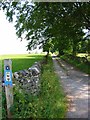
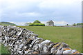
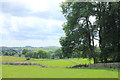
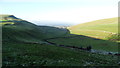
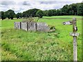
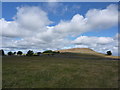
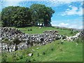
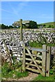
Photos of Alstonefield
Area Information
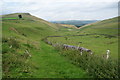
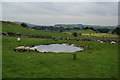
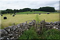
Living in Alstonefield defines a quiet existence within a civil parish spread across 14.3 km² of English countryside. This rural settlement offers a distinct pace of life far removed from urban density, appealing to those seeking isolation yet remaining close to broader connections. The village character remains intact, with homes usually surrounded by open spaces rather than congested streets. You will find a community that values stability and tradition, reflected in the demographic profile and the lack of significant planning constraints like protected nature reserves or wetlands. While the area does not feature a nature reserve under the AONB classification, it avoids the strictest restrictions associated with Ramsar sites or designated beautiful landscapes. Daily life revolves around local needs, with residents relying on established routines rather than the fast pace of city living. The low population density means you walk to familiar spots without encountering traffic congestion. Shoppers and commuters face a trade-off; convenience requires travel, but the return brings peace. This environment suits families who prioritise space and privacy over immediate access to high streets. You should be comfortable with a self-contained lifestyle where the nearest amenities require a drive. The overall impression is one of calm stability, making it an attractive option for retirement or those wishing to raise children away from urban noise.
- Area Type
- Parish
- Area Size
- 14.3 km²
- Population
- Not available
- Population Density
- Not available
Demographics
The community in Alstonefield is defined by an exceptionally mature population, with a median age of 70 years old. This figure indicates a settlement dominated by older residents, likely retirees who have moved to the area for its tranquil setting. The most common age range aligns with this statistical reality, creating a neighbourhood where you will predominantly meet elderly neighbours. Home ownership stands at 81 per cent, revealing a thoroughly established property market where residents have typically owned their homes for many years. This high rate suggests long-term stability rather than a transient population of renters or new arrivals. Household composition reflects the older demographic, with fewer young families or single professionals than you would find in urban zones. Accommodation types generally mirror this ownership model, consisting mainly of detached houses suited to older occupants. Diversity metrics regarding ethnicity and religion show the total figures recorded for the parish, without specific breakdowns indicating a highly multicultural mix. You should expect a homogenous community bound by shared values rather than recent migration patterns. Deprivation data is not present, but the high ownership rate and age profile imply financial prudence among current residents. Life here lacks the vibrancy of youth-centric hubs, offering instead a settled rhythm focused on local governance and leisure.
Household Size
Accommodation Type
Tenure
Ethnic Group
Religion
Household Composition
Age
Household Deprivation
NS-SEC
Explore more demographic insights in this area
Go to Demographics tabPlanning
Planning Constraints
- Flood RiskPremium
- Ramsar Wetland SitesPremium
- Area of Outstanding Natural BeautyPremium
- Protected Nature ReservePremium
- Crime RiskPremium