Area Overview for Alrewas & Fradley Ward
Photos of Alrewas & Fradley Ward
Area Information
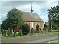
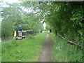
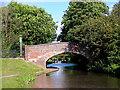
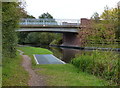
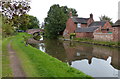
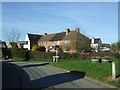
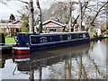
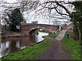
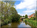
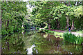
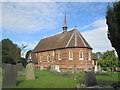
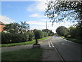
Living in Alrewas & Fradley Ward offers residents a distinct character defined by its rural history and canal heritage. This district borough unitary ward encompasses 24.8 km² of Staffordshire, home to a population of 1,918. The area includes the villages of Alrewas, Fradley, and Orgreave, with Fradley known for its canal junction and Alrewas recognised for walks along the River Trent. Residents enjoy proximity to the A38 Roman road and are served by the Diamond Bus service 12 linking to Lichfield and Burton. The landscape features significant historical assets such as St Stephen's Church and 16th-century Old Hall Farm. You will find the area was formed from the merger of Alrewas and Fradley civil parishes before being split further in 2023. Families and retirees navigate a setting where wooden architecture and waterways meet modern road infrastructure. The ward sits within the West Midlands region, providing a blend of countryside access and regional connectivity. Daily life revolves around the quiet pace of village living, yet remains linked to broader employment centres through existing transport links.
- Area Type
- District Borough Unitary Ward
- Area Size
- 24.8 km²
- Population
- 1918
- Population Density
- 995 people/km²
Demographics
The community in Alrewas & Fradley Ward displays a clear demographic profile shaped by its settlement history. The median age across the area stands at 70 years. This figure reflects a population where the majority of residents are older adults rather than young families or young professionals. Housing tenure in Alrewas & Fradley Ward shows a home ownership rate of 80%. This high level indicates that most households have purchased their property rather than holding a tenancy agreement. The lower density of the 24.8 km² ward contributes to this stability, creating a neighbourhood where long-term residents are common. Household composition data shows a total category, suggesting a variety of living arrangements typical of a mature community. You will find that the population density reaches 995 people per km², which feels rural compared to urban boroughs. The ethnic group and religious data are recorded as total categories, meaning no single majority defines the demographic landscape beyond the age skew. Living in Alrewas & Fradley Ward means joining a stable, older community where ownership is the norm.
Household Size
Accommodation Type
Tenure
Ethnic Group
Religion
Household Composition
Age
Household Deprivation
NS-SEC
Explore more demographic insights in this area
Go to Demographics tabPlanning
Planning Constraints
- Flood RiskPremium
- Ramsar Wetland SitesPremium
- Area of Outstanding Natural BeautyPremium
- Protected Nature ReservePremium
- Protected WoodlandPremium