Area Overview for WR11 7TT
Photos of WR11 7TT
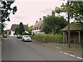
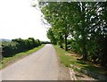
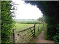
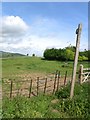
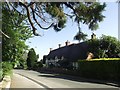
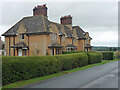
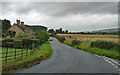
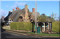
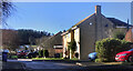
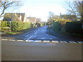
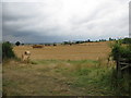
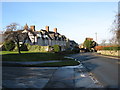
22 photos from this area
Area Information
Key information about the WR11 7TT including its size, population, and administrative classification.
- Area Type
- Postcode
- Area Size
- 2.7 hectares
- Population
- 2042
- Population Density
- 33 people/km²
House Prices in WR11 7TT
18
Properties
£272,982
Average Sold Price
£126,500
Lowest Price
£490,000
Highest Price
Showing 18 properties
| Address | Type | Beds | Baths | Last Sale Price | Last Sale Date | |
|---|---|---|---|---|---|---|
| 17 Garden Close, Dumbleton, Evesham, WR11 7TT | Retail | 2 | 1 | £365,250 | Apr 2022 | |
| 18 Garden Close, Dumbleton, Evesham, WR11 7TT | Detached | 2 | 2 | £490,000 | Oct 2020 | |
| 2 Garden Close, Dumbleton, Evesham, WR11 7TT | house | 2 | 2 | £362,500 | Nov 2019 | |
| 5 Garden Close, Dumbleton, Evesham, WR11 7TT | house | - | - | £395,000 | Oct 2018 | |
| 19 Garden Close, Dumbleton, Evesham, WR11 7TT | Detached | - | - | £135,000 | May 2018 | |
| 15 Garden Close, Dumbleton, Evesham, WR11 7TT | Semi-detached | 2 | 1 | £239,000 | Nov 2016 | |
| 16 Garden Close, Dumbleton, Evesham, WR11 7TT | Bungalow | - | - | £227,500 | Nov 2015 | |
| 4 Garden Close, Dumbleton, Evesham, WR11 7TT | house | - | - | £249,000 | May 2010 | |
| 1 Garden Close, Dumbleton, Evesham, WR11 7TT | house | 3 | 1 | £235,000 | Apr 2009 | |
| 9 Garden Close, Dumbleton, Evesham, WR11 7TT | house | - | - | £340,000 | Aug 2007 |
Page 1 of 2
Energy Efficiency in WR11 7TT
Amenities
Schools
| Rank | School | Type | Entry gender | Ages |
|---|
Explore more schools in this area
Go to Schools tabDemographics
Household Size
Two person
most common
Accommodation Type
Houses
most common
Tenure
82
majority
Ethnic Group
White
most common
Religion
N/A
most common
Household Composition
N/A
most common
Age
47
median
Adults (30-64 years)
most common
Household Deprivation
N/A
with no deprivation
NS-SEC
47
in Lower managerial occupations
Explore more demographic insights in this area
Go to Demographics tabPlanning
Planning Constraints
- Flood RiskPremium
- Ramsar Wetland SitesPremium
- Area of Outstanding Natural BeautyPremium
- Protected Nature ReservePremium
- Protected WoodlandPremium