Area Overview for WR11 7QW
Photos of WR11 7QW
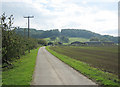
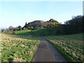
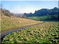

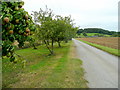
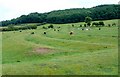
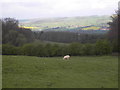
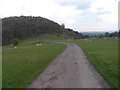
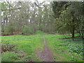
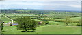
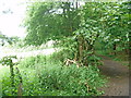
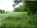
30 photos from this area
Area Information
Key information about the WR11 7QW including its size, population, and administrative classification.
- Area Type
- Postcode
- Area Size
- 1.5 km²
- Population
- 2042
- Population Density
- 33 people/km²
House Prices in WR11 7QW
16
Properties
£473,083
Average Sold Price
£285,000
Lowest Price
£1,040,000
Highest Price
Showing 16 properties
| Address | Type | Beds | Baths | Last Sale Price | Last Sale Date | |
|---|---|---|---|---|---|---|
| 2, Didcot Cottages, Beckford Road, Dumbleton, Evesham, WR11 7QW | Semi-detached | 3 | 2 | £472,500 | Dec 2023 | |
| Colby, Beckford Road, Dumbleton, Evesham, WR11 7QW | house | - | - | £1,040,000 | Dec 2020 | |
| 3, The Gables, Beckford Road, Dumbleton, Evesham, WR11 7QW | Terraced | 2 | - | £285,000 | Jun 2014 | |
| Green Acres, Beckford Road, Dumbleton, Evesham, WR11 7QW | Bungalow | - | - | £323,000 | Jan 2010 | |
| North Lodge, Beckford Road, Dumbleton, Evesham, WR11 7QW | house | - | - | £400,000 | Nov 2008 | |
| Clova, Beckford Road, Dumbleton, Evesham, WR11 7QW | Bungalow | - | - | £318,000 | Sep 2005 | |
| 2, The Gables, Beckford Road, Dumbleton, Evesham, WR11 7QW | Terraced | 3 | 1 | - | - | |
| Didcot Cottages, Beckford Road, Dumbleton, Evesham, WR11 7QW | Semi-detached | - | - | - | - | |
| The Gables, Beckford Road, Dumbleton, Evesham, WR11 7QW | Terraced | - | - | - | - | |
| 1, The Gables, Beckford Road, Dumbleton, Evesham, WR11 7QW | Terraced | 2 | - | - | - |
Page 1 of 2
Energy Efficiency in WR11 7QW
Amenities
Schools
| Rank | School | Type | Entry gender | Ages |
|---|
Explore more schools in this area
Go to Schools tabDemographics
Household Size
Two person
most common
Accommodation Type
Houses
most common
Tenure
82
majority
Ethnic Group
White
most common
Religion
N/A
most common
Household Composition
N/A
most common
Age
47
median
Adults (30-64 years)
most common
Household Deprivation
N/A
with no deprivation
NS-SEC
47
in Lower managerial occupations
Explore more demographic insights in this area
Go to Demographics tabPlanning
Planning Constraints
- Flood RiskPremium
- Ramsar Wetland SitesPremium
- Area of Outstanding Natural BeautyPremium
- Protected Nature ReservePremium
- Protected WoodlandPremium