Area Overview for Haydon Wick
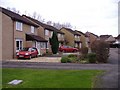
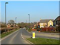
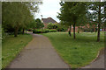
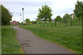
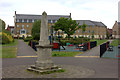
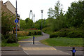
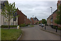
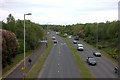
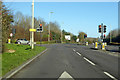
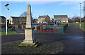
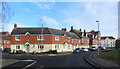
Photos of Haydon Wick

Area Information
Living in Haydon Wick offers a distinct experience within the Staffordshire Moors, characterised by a high degree of monopolisation and low density relative to some urban counterparts. This district, designated as a borough unitary ward, covers an area of exactly 6.0 km² while housing a population of 5,537 people. The resulting population density stands at 928 people per square kilometre, indicating a community that is compact enough to foster local connections yet spacious enough to feel removed from the congestion of major city centres. You will find that daily life here revolves around a principle of proximity and stability. The sheer number of residents living within such a defined geographical boundary suggests a close-knit environment where neighbours are likely to know each other by name. This setting is not merely a statistical aggregation but a lived reality where the scale of the ward dictates the pace of living. You should expect a pace that is measured rather than hurried, supported by infrastructure designed to serve a static, established population rather than a transient workforce. The location offers a straightforward appeal for those prioritising space and community over the frenetic energy of larger metropolitan areas. Haydon Wick presents a clear choice for individuals seeking a settlement where the footprint of development matches the needs of its inhabitants without unnecessary sprawl.
- Area Type
- Parish
- Area Size
- 6.0 km²
- Population
- 5537
- Population Density
- 928 people/km²
Demographics
The community profile of Haydon Wick reveals a demographic settled deep into retirement and stability. The area boasts a median age of 70 years, a figure that starkly contrasts with the national average and defines the social fabric you will encounter. This advanced age profile indicates that the most common age range spans well into mature adulthood, suggesting a neighbourhood where families with young children are a minority presence. With 79% of households in Haydon Wick achieving home ownership, the area feels predominantly composed of long-term residents who have ploughed their savings into buying rather than renting. This high ownership rate just over three-quarters of the population translates to a market driven by investment and heritage rather than speculative renting or student housing. You can expect a population that has put down roots, creating a society with significant generational continuity. The accommodation types and household compositions reflect this stability, resulting in fewer short-term tenancies and a slower turnover of residents. When you consider who lives here, you are looking at retired professionals and established couples seeking their twilight years in a familiar, secure environment. This demographic data confirms that Haydon Wick functions as a sanctuary rather than a transit point for the population.
Household Size
Accommodation Type
Tenure
Ethnic Group
Religion
Household Composition
Age
Household Deprivation
NS-SEC
Explore more demographic insights in this area
Go to Demographics tabPlanning
Planning Constraints
- Flood RiskPremium
- Ramsar Wetland SitesPremium
- Area of Outstanding Natural BeautyPremium
- Protected Nature ReservePremium
- Protected WoodlandPremium