Area Overview for TR6 0EW
Photos of TR6 0EW
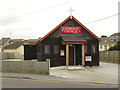
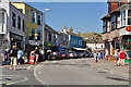
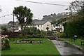
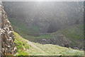
100 photos from this area
Area Information
Key information about the TR6 0EW including its size, population, and administrative classification.
- Area Type
- Postcode
- Area Size
- 5348 m²
- Population
- 1289
- Population Density
- 1176 people/km²
House Prices in TR6 0EW
10
Properties
-
Average Sold Price
-
Lowest Price
-
Highest Price
Showing 10 properties
| Address | Type | Beds | Baths | Last Sale Price | Last Sale Date | |
|---|---|---|---|---|---|---|
| Flat 1, Mitchells Corner, Boscawen Road, Perranporth, TR6 0EW | Restaurant | - | - | - | - | |
| The Flat, 5 Boscawen Road, Perranporth, TR6 0EW | Flat | 3 | 1 | - | - | |
| Second Floor Offices, 1 Boscawen Road, Perranporth, TR6 0EW | Office | - | - | - | - | |
| Flat, 4 Boscawen Road, Perranporth, TR6 0EW | Flat | - | - | - | - | |
| Direct Aromatherapy Ltd, First Floor, The Red House, Boscawen Road, Perranporth, TR6 0EW | Office | - | - | - | - | |
| Managers Flat, Upper Deck, 3 Boscawen Road, Perranporth, TR6 0EW | Flat | - | - | - | - | |
| The Masonic Hall, Boscawen Road, Perranporth, TR6 0EW | assembly_leisure | - | - | - | - | |
| Flat 2, Mitchells Corner, Boscawen Road, Perranporth, TR6 0EW | Flat | - | - | - | - | |
| Sea Pinks Ladies Fashion, 5 Boscawen Road, Perranporth, TR6 0EW | shop | - | - | - | - | |
| The Loft Studio, 4A Boscawen Road, Perranporth, TR6 0EW | Flat | - | - | - | - |
Energy Efficiency in TR6 0EW
Amenities
Schools
| Rank | School | Type | Entry gender | Ages |
|---|
Explore more schools in this area
Go to Schools tabDemographics
Household Size
One person
most common
Accommodation Type
Houses
most common
Tenure
58
majority
Ethnic Group
White
most common
Religion
N/A
most common
Household Composition
N/A
most common
Age
47
median
Adults (30-64 years)
most common
Household Deprivation
N/A
with no deprivation
NS-SEC
30
in Lower managerial occupations
Explore more demographic insights in this area
Go to Demographics tabPlanning
Planning Constraints
- Flood RiskPremium
- Ramsar Wetland SitesPremium
- Area of Outstanding Natural BeautyPremium
- Protected Nature ReservePremium
- Protected WoodlandPremium