Area Overview for TR6 0BH
Photos of TR6 0BH
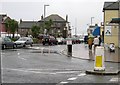
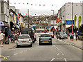
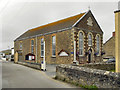
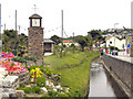
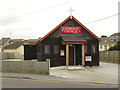
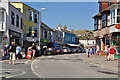
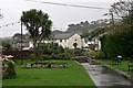
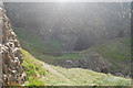
100 photos from this area
Area Information
Key information about the TR6 0BH including its size, population, and administrative classification.
- Area Type
- Postcode
- Area Size
- 3.1 hectares
- Population
- 1289
- Population Density
- 1176 people/km²
House Prices in TR6 0BH
43
Properties
£216,208
Average Sold Price
£29,000
Lowest Price
£560,000
Highest Price
Showing 43 properties
| Address | Type | Beds | Baths | Last Sale Price | Last Sale Date | |
|---|---|---|---|---|---|---|
| Tewyn Views, 26A St Pirans Road, Perranporth, TR6 0BH | Detached | 2 | 2 | £260,000 | Jul 2025 | |
| Lowenek House, 22 St Pirans Road, Perranporth, TR6 0BH | Detached | 6 | 2 | £560,000 | Mar 2025 | |
| 28A St Pirans Road, Perranporth, TR6 0BH | Flat | 2 | 1 | £240,000 | Jan 2024 | |
| Beechcroft, 23 St Pirans Road, Perranporth, TR6 0BH | house | 4 | 1 | £245,000 | Sep 2018 | |
| 25 St Pirans Road, Perranporth, TR6 0BH | Flat | - | - | £175,000 | Nov 2016 | |
| 27A St Pirans Road, Perranporth, TR6 0BH | Flat | - | - | £150,000 | Sep 2016 | |
| 13 St Pirans Road, Perranporth, TR6 0BH | Maisonette | 3 | - | £195,000 | Mar 2016 | |
| 21 St Pirans Road, Perranporth, TR6 0BH | Bungalow | 3 | - | £255,000 | Sep 2010 | |
| 25A St Pirans Road, Perranporth, TR6 0BH | Flat | 1 | 2 | £153,000 | Dec 2009 | |
| Tamara, 10 St Pirans Road, Perranporth, TR6 0BH | house | - | - | £285,000 | Sep 2009 |
Page 1 of 5
Energy Efficiency in TR6 0BH
Amenities
Schools
| Rank | School | Type | Entry gender | Ages |
|---|
Explore more schools in this area
Go to Schools tabDemographics
Household Size
One person
most common
Accommodation Type
Houses
most common
Tenure
58
majority
Ethnic Group
White
most common
Religion
N/A
most common
Household Composition
N/A
most common
Age
47
median
Adults (30-64 years)
most common
Household Deprivation
N/A
with no deprivation
NS-SEC
30
in Lower managerial occupations
Explore more demographic insights in this area
Go to Demographics tabPlanning
Planning Constraints
- Flood RiskPremium
- Ramsar Wetland SitesPremium
- Area of Outstanding Natural BeautyPremium
- Protected Nature ReservePremium
- Protected WoodlandPremium