Area Overview for TR6 0DR
Photos of TR6 0DR
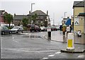
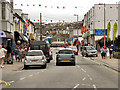
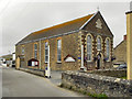
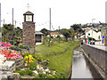
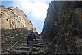
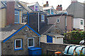
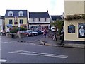
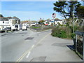
100 photos from this area
Area Information
Key information about the TR6 0DR including its size, population, and administrative classification.
- Area Type
- Postcode
- Area Size
- 1.5 hectares
- Population
- 1289
- Population Density
- 1176 people/km²
House Prices in TR6 0DR
48
Properties
£332,820
Average Sold Price
£83,500
Lowest Price
£650,000
Highest Price
Showing 48 properties
| Address | Type | Beds | Baths | Last Sale Price | Last Sale Date | |
|---|---|---|---|---|---|---|
| 7, Oceans, Cliff Road, Perranporth, TR6 0DR | Flat | - | - | £650,000 | Jan 2025 | |
| Cliff Nook, Cliff Road, Perranporth, TR6 0DR | house | - | - | £250,500 | Jun 2021 | |
| Cliff Cottage, Cliff Road, Perranporth, TR6 0DR | house | - | - | £330,100 | Dec 2020 | |
| Lynton, Cliff Road, Perranporth, TR6 0DR | Detached | - | - | £350,000 | Jun 2014 | |
| Cliff House, Cliff Road, Perranporth, TR6 0DR | house | 4 | 2 | £83,500 | Jun 2007 | |
| Flat 1, Droskyn Castle, Cliff Road, Perranporth, TR6 0DR | Flat | 4 | 3 | - | - | |
| Atlantic House, Cliff Road, Perranporth, TR6 0DR | Terraced | 6 | 4 | - | - | |
| Perran Cottage, Cliff Road, Perranporth, TR6 0DR | house | 2 | 1 | - | - | |
| FLAT 12, DROSKYN CASTLE, CLIFF ROAD, Perranporth, TR6 0DR | Flat | - | - | - | - | |
| Little Cherburg, Cliff Road, Perranporth, TR6 0DR | Semi-detached | 5 | 3 | - | - |
Page 1 of 5
Energy Efficiency in TR6 0DR
Amenities
Schools
| Rank | School | Type | Entry gender | Ages |
|---|
Explore more schools in this area
Go to Schools tabDemographics
Household Size
One person
most common
Accommodation Type
Houses
most common
Tenure
58
majority
Ethnic Group
White
most common
Religion
N/A
most common
Household Composition
N/A
most common
Age
47
median
Adults (30-64 years)
most common
Household Deprivation
N/A
with no deprivation
NS-SEC
30
in Lower managerial occupations
Explore more demographic insights in this area
Go to Demographics tabPlanning
Planning Constraints
- Flood RiskPremium
- Ramsar Wetland SitesPremium
- Area of Outstanding Natural BeautyPremium
- Protected Nature ReservePremium
- Protected WoodlandPremium