Area Overview for TR6 0DP
Photos of TR6 0DP
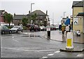
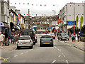

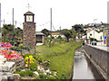


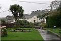


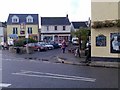
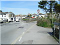
100 photos from this area
Area Information
Key information about the TR6 0DP including its size, population, and administrative classification.
- Area Type
- Postcode
- Area Size
- 25.9 hectares
- Population
- 1289
- Population Density
- 1176 people/km²
House Prices in TR6 0DP
12
Properties
£371,400
Average Sold Price
£72,000
Lowest Price
£795,000
Highest Price
Showing 12 properties
| Address | Type | Beds | Baths | Last Sale Price | Last Sale Date | |
|---|---|---|---|---|---|---|
| Abbotsleigh, Cliff Road, Perranporth, TR6 0DP | Semi-detached | 4 | 2 | £635,000 | Sep 2025 | |
| Downside, Lower Tywarnhayle Road, Perranporth, TR6 0DP | Bungalow | 5 | 4 | £795,000 | May 2022 | |
| Hortensia, Lower Tywarnhayle Road, Perranporth, TR6 0DP | Bungalow | 2 | 1 | £160,000 | Aug 2019 | |
| Mount Stuart, Lower Tywarnhayle Road, Perranporth, TR6 0DP | Bungalow | 3 | - | £195,000 | Nov 2017 | |
| Penhale Villa, Cliff Road, Perranporth, TR6 0DP | house | - | - | £72,000 | Nov 1997 | |
| Michaelstow, Cliff Road, Perranporth, TR6 0DP | hotel | 4 | 1 | - | - | |
| The Annexe, Downside, Lower Tywarnhayle Road, Perranporth, TR6 0DP | Semi-detached | 3 | - | - | - | |
| Flat 1, Penhale House, Cliff Road, Perranporth, TR6 0DP | Flat | - | - | - | - | |
| Flat 4, Penhale House, Cliff Road, Perranporth, TR6 0DP | house | - | - | - | - | |
| Flat 2, Penhale House, Cliff Road, Perranporth, TR6 0DP | Flat | - | - | - | - |
Page 1 of 2
Energy Efficiency in TR6 0DP
Amenities
Schools
| Rank | School | Type | Entry gender | Ages |
|---|
Explore more schools in this area
Go to Schools tabDemographics
Household Size
One person
most common
Accommodation Type
Houses
most common
Tenure
58
majority
Ethnic Group
White
most common
Religion
N/A
most common
Household Composition
N/A
most common
Age
47
median
Adults (30-64 years)
most common
Household Deprivation
N/A
with no deprivation
NS-SEC
30
in Lower managerial occupations
Explore more demographic insights in this area
Go to Demographics tabPlanning
Planning Constraints
- Flood RiskPremium
- Ramsar Wetland SitesPremium
- Area of Outstanding Natural BeautyPremium
- Protected Nature ReservePremium
- Protected WoodlandPremium