Area Overview for TR27 6PH
Photos of TR27 6PH
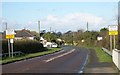
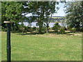
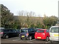
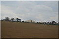
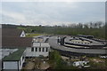
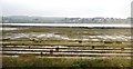
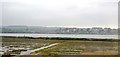
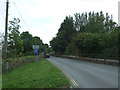
79 photos from this area
Area Information
Key information about the TR27 6PH including its size, population, and administrative classification.
- Area Type
- Postcode
- Area Size
- 4067 m²
- Population
- 1537
- Population Density
- 1613 people/km²
House Prices in TR27 6PH
23
Properties
£148,545
Average Sold Price
£36,500
Lowest Price
£275,000
Highest Price
Showing 23 properties
| Address | Type | Beds | Baths | Last Sale Price | Last Sale Date | |
|---|---|---|---|---|---|---|
| 71 Trelissick Fields, Hayle, TR27 6PH | Terraced | 2 | 1 | £275,000 | Jun 2023 | |
| 94 Trelissick Fields, Hayle, TR27 6PH | Terraced | 2 | 1 | £275,000 | Nov 2022 | |
| 83 Trelissick Fields, Hayle, TR27 6PH | house | - | - | £230,000 | Nov 2021 | |
| 80 Trelissick Fields, Hayle, TR27 6PH | Terraced | 2 | - | £175,000 | Feb 2018 | |
| 82 Trelissick Fields, Hayle, TR27 6PH | Terraced | 3 | 1 | £175,000 | Sep 2017 | |
| 81 Trelissick Fields, Hayle, TR27 6PH | Terraced | 2 | - | £169,000 | Dec 2016 | |
| 74 Trelissick Fields, Hayle, TR27 6PH | Terraced | 2 | 1 | £168,000 | Apr 2016 | |
| 78 Trelissick Fields, Hayle, TR27 6PH | Terraced | 2 | 1 | £163,000 | Jul 2015 | |
| 86 Trelissick Fields, Hayle, TR27 6PH | Terraced | 2 | - | £164,000 | Dec 2013 | |
| 92 Trelissick Fields, Hayle, TR27 6PH | Terraced | 2 | 1 | £162,000 | Sep 2013 |
Page 1 of 3
Energy Efficiency in TR27 6PH
Amenities
Schools
| Rank | School | Type | Entry gender | Ages |
|---|
Explore more schools in this area
Go to Schools tabDemographics
Household Size
Two person
most common
Accommodation Type
Houses
most common
Tenure
85
majority
Ethnic Group
White
most common
Religion
N/A
most common
Household Composition
N/A
most common
Age
47
median
Adults (30-64 years)
most common
Household Deprivation
N/A
with no deprivation
NS-SEC
30
in Lower managerial occupations
Explore more demographic insights in this area
Go to Demographics tabPlanning
Planning Constraints
- Flood RiskPremium
- Ramsar Wetland SitesPremium
- Area of Outstanding Natural BeautyPremium
- Protected Nature ReservePremium
- Protected WoodlandPremium