Area Overview for TR27 6JA
Photos of TR27 6JA
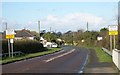
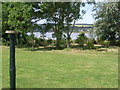
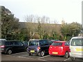
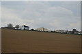
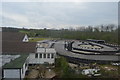
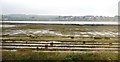
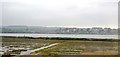
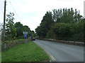
80 photos from this area
Area Information
Key information about the TR27 6JA including its size, population, and administrative classification.
- Area Type
- Postcode
- Area Size
- 4708 m²
- Population
- 1537
- Population Density
- 1613 people/km²
House Prices in TR27 6JA
9
Properties
£217,889
Average Sold Price
£59,550
Lowest Price
£386,000
Highest Price
Showing 9 properties
| Address | Type | Beds | Baths | Last Sale Price | Last Sale Date | |
|---|---|---|---|---|---|---|
| 7 Bownder Dowr, Hayle, TR27 6JA | Bungalow | - | - | £386,000 | Nov 2022 | |
| 2 Bownder Dowr, Hayle, TR27 6JA | Bungalow | 3 | - | £275,000 | Nov 2016 | |
| 1 Bownder Dowr, Hayle, TR27 6JA | Bungalow | 4 | - | £310,000 | Aug 2014 | |
| 6 Bownder Dowr, Hayle, TR27 6JA | Bungalow | 3 | 2 | £242,000 | Dec 2013 | |
| 4 Bownder Dowr, Hayle, TR27 6JA | Detached | 3 | - | £232,500 | Jan 2011 | |
| 5 Bownder Dowr, Hayle, TR27 6JA | Detached | - | - | £59,550 | Jun 2008 | |
| 9 Bownder Dowr, Hayle, TR27 6JA | Bungalow | 3 | 2 | £250,000 | Oct 2004 | |
| 8 Bownder Dowr, Hayle, TR27 6JA | Bungalow | 3 | 1 | £129,950 | Jul 2001 | |
| 3 Bownder Dowr, Hayle, TR27 6JA | Detached | - | - | £76,000 | Jun 1996 |
Energy Efficiency in TR27 6JA
Amenities
Schools
| Rank | School | Type | Entry gender | Ages |
|---|
Explore more schools in this area
Go to Schools tabDemographics
Household Size
Two person
most common
Accommodation Type
Houses
most common
Tenure
85
majority
Ethnic Group
White
most common
Religion
N/A
most common
Household Composition
N/A
most common
Age
47
median
Adults (30-64 years)
most common
Household Deprivation
N/A
with no deprivation
NS-SEC
30
in Lower managerial occupations
Explore more demographic insights in this area
Go to Demographics tabPlanning
Planning Constraints
- Flood RiskPremium
- Ramsar Wetland SitesPremium
- Area of Outstanding Natural BeautyPremium
- Protected Nature ReservePremium
- Protected WoodlandPremium