Area Overview for TR26 2TR
Photos of TR26 2TR
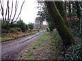
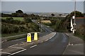
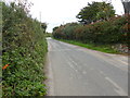
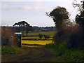
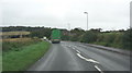
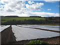
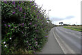
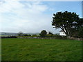
17 photos from this area
Area Information
Key information about the TR26 2TR including its size, population, and administrative classification.
- Area Type
- Postcode
- Area Size
- 1.3 hectares
- Population
- 1507
- Population Density
- 1243 people/km²
House Prices in TR26 2TR
19
Properties
£227,418
Average Sold Price
£120,000
Lowest Price
£360,000
Highest Price
Showing 19 properties
| Address | Type | Beds | Baths | Last Sale Price | Last Sale Date | |
|---|---|---|---|---|---|---|
| 5 Tryhornek, Carbis Bay, TR26 2TR | Flat | 2 | 2 | £245,000 | Jul 2025 | |
| 1 Tryhornek, Carbis Bay, TR26 2TR | Bungalow | 2 | 1 | £360,000 | Feb 2023 | |
| 9 Tryhornek, Carbis Bay, TR26 2TR | Semi-detached | 2 | 2 | £305,000 | Mar 2021 | |
| 3 Tryhornek, Carbis Bay, TR26 2TR | Flat | - | - | £320,000 | Dec 2020 | |
| 10 Tryhornek, Carbis Bay, TR26 2TR | Semi-detached | 2 | 2 | £285,000 | Aug 2020 | |
| 7 Tryhornek, Carbis Bay, TR26 2TR | Flat | - | - | £120,000 | Jan 2020 | |
| 8 Tryhornek, Carbis Bay, TR26 2TR | Flat | - | - | £217,000 | Sep 2017 | |
| 15 Tryhornek, Carbis Bay, TR26 2TR | Flat | - | - | £195,000 | Jul 2017 | |
| 20 Tryhornek, Carbis Bay, TR26 2TR | Terraced | 2 | 2 | £295,000 | Jun 2017 | |
| 11 Tryhornek, Carbis Bay, TR26 2TR | Semi-detached | 2 | - | £255,000 | Jul 2016 |
Page 1 of 2
Energy Efficiency in TR26 2TR
Amenities
Schools
| Rank | School | Type | Entry gender | Ages |
|---|
Explore more schools in this area
Go to Schools tabDemographics
Household Size
Two person
most common
Accommodation Type
Houses
most common
Tenure
74
majority
Ethnic Group
White
most common
Religion
N/A
most common
Household Composition
N/A
most common
Age
47
median
Adults (30-64 years)
most common
Household Deprivation
N/A
with no deprivation
NS-SEC
30
in Lower managerial occupations
Explore more demographic insights in this area
Go to Demographics tabPlanning
Planning Constraints
- Flood RiskPremium
- Ramsar Wetland SitesPremium
- Area of Outstanding Natural BeautyPremium
- Protected Nature ReservePremium
- Protected WoodlandPremium