Area Overview for TR26 2TD
Photos of TR26 2TD
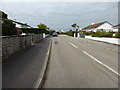
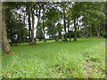
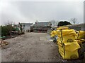
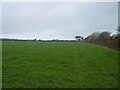
21 photos from this area
Area Information
Key information about the TR26 2TD including its size, population, and administrative classification.
- Area Type
- Postcode
- Area Size
- 1.6 hectares
- Population
- 1507
- Population Density
- 1243 people/km²
House Prices in TR26 2TD
19
Properties
£547,850
Average Sold Price
£289,950
Lowest Price
£995,000
Highest Price
Showing 19 properties
| Address | Type | Beds | Baths | Last Sale Price | Last Sale Date | |
|---|---|---|---|---|---|---|
| Chatsworth Lodge, Trencrom Lane, Carbis Bay, TR26 2TD | Detached | 3 | 2 | £515,000 | Nov 2024 | |
| 14 Trencrom Lane, Carbis Bay, TR26 2TD | Bungalow | - | - | £635,000 | Aug 2023 | |
| Tregonnis, 12 Trencrom Lane, Carbis Bay, TR26 2TD | Flat | 2 | 2 | £600,000 | Apr 2023 | |
| The Firs, Trencrom Lane, Carbis Bay, TR26 2TD | Terraced | 3 | 1 | £405,000 | Apr 2023 | |
| Trencrom House, Trencrom Lane, Carbis Bay, TR26 2TD | Detached | 4 | 4 | £995,000 | Sep 2021 | |
| Rose Cottage, Trencrom Lane, Carbis Bay, TR26 2TD | Terraced | 2 | - | £289,950 | May 2014 | |
| Fox Cottage, Trencrom Lane, Carbis Bay, TR26 2TD | house | - | - | £395,000 | Jan 2013 | |
| 13 Trencrom Lane, Carbis Bay, TR26 2TD | Detached | 3 | 2 | - | - | |
| 4, Trevithick, Rotorua Apartments, Trencrom Lane, Carbis Bay, TR26 2TD | Flat | 2 | 1 | - | - | |
| 8, Trevessa, Rotorua Apartments, Trencrom Lane, Carbis Bay, TR26 2TD | Flat | 2 | 1 | - | - |
Page 1 of 2
Energy Efficiency in TR26 2TD
Amenities
Schools
| Rank | School | Type | Entry gender | Ages |
|---|
Explore more schools in this area
Go to Schools tabDemographics
Household Size
Two person
most common
Accommodation Type
Houses
most common
Tenure
74
majority
Ethnic Group
White
most common
Religion
N/A
most common
Household Composition
N/A
most common
Age
47
median
Adults (30-64 years)
most common
Household Deprivation
N/A
with no deprivation
NS-SEC
30
in Lower managerial occupations
Explore more demographic insights in this area
Go to Demographics tabPlanning
Planning Constraints
- Flood RiskPremium
- Ramsar Wetland SitesPremium
- Area of Outstanding Natural BeautyPremium
- Protected Nature ReservePremium
- Protected WoodlandPremium