Area Overview for TR26 2ET
Photos of TR26 2ET
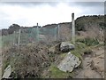
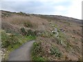
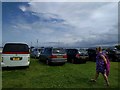
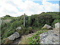
45 photos from this area
Area Information
Key information about the TR26 2ET including its size, population, and administrative classification.
- Area Type
- Postcode
- Area Size
- 7511 m²
- Population
- 1186
- Population Density
- 2702 people/km²
House Prices in TR26 2ET
30
Properties
£159,800
Average Sold Price
£37,000
Lowest Price
£310,000
Highest Price
Showing 30 properties
| Address | Type | Beds | Baths | Last Sale Price | Last Sale Date | |
|---|---|---|---|---|---|---|
| 3 Praze An Creet, St Ives, TR26 2ET | Terraced | 2 | 1 | £209,000 | Dec 2024 | |
| 55 Praze An Creet, St Ives, TR26 2ET | Retail | 3 | 1 | £310,000 | May 2022 | |
| 12 Praze An Creet, St Ives, TR26 2ET | Terraced | 2 | 1 | £190,000 | Sep 2020 | |
| 6 Praze An Creet, St Ives, TR26 2ET | house | 2 | - | £195,000 | Mar 2019 | |
| 15 Praze An Creet, St Ives, TR26 2ET | Terraced | 2 | - | £186,500 | Oct 2018 | |
| 17 Praze An Creet, St Ives, TR26 2ET | Terraced | 2 | 1 | £175,000 | Jun 2018 | |
| 51 Praze An Creet, St Ives, TR26 2ET | house | - | - | £200,250 | Jul 2017 | |
| 2 Praze An Creet, St Ives, TR26 2ET | Terraced | 3 | 1 | £177,000 | Feb 2016 | |
| 57 Praze An Creet, St Ives, TR26 2ET | Terraced | 3 | - | £175,000 | Sep 2014 | |
| 8 Praze An Creet, St Ives, TR26 2ET | Terraced | 2 | - | £140,000 | May 2014 |
Page 1 of 3
Energy Efficiency in TR26 2ET
Amenities
Schools
| Rank | School | Type | Entry gender | Ages |
|---|
Explore more schools in this area
Go to Schools tabDemographics
Household Size
Two person
most common
Accommodation Type
Houses
most common
Tenure
77
majority
Ethnic Group
White
most common
Religion
N/A
most common
Household Composition
N/A
most common
Age
47
median
Adults (30-64 years)
most common
Household Deprivation
N/A
with no deprivation
NS-SEC
28
in Lower managerial occupations
Explore more demographic insights in this area
Go to Demographics tabPlanning
Planning Constraints
- Flood RiskPremium
- Ramsar Wetland SitesPremium
- Area of Outstanding Natural BeautyPremium
- Protected Nature ReservePremium
- Protected WoodlandPremium