Area Overview for TR20 9NA
Photos of TR20 9NA
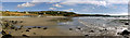
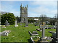
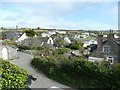
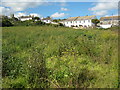
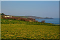
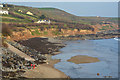
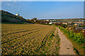

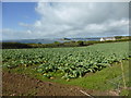
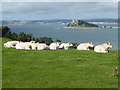
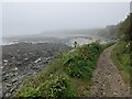
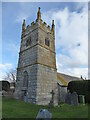
40 photos from this area
Area Information
Key information about the TR20 9NA including its size, population, and administrative classification.
- Area Type
- Postcode
- Area Size
- 1.8 hectares
- Population
- 1846
- Population Density
- 327 people/km²
House Prices in TR20 9NA
12
Properties
£328,300
Average Sold Price
£145,000
Lowest Price
£642,000
Highest Price
Showing 12 properties
| Address | Type | Beds | Baths | Last Sale Price | Last Sale Date | |
|---|---|---|---|---|---|---|
| 5 The Elms, Perranuthnoe, TR20 9NA | Terraced | 2 | 1 | £400,000 | Dec 2022 | |
| 3 The Elms, Perranuthnoe, TR20 9NA | house | - | - | £315,000 | Jun 2020 | |
| Parc An Praze, St Pirans Way, Perranuthnoe, TR20 9NA | house | - | - | £642,000 | Mar 2020 | |
| 6 The Elms, Perranuthnoe, TR20 9NA | house | 2 | 1 | £280,000 | Dec 2019 | |
| Hendra, 2 The Elms, Perranuthnoe, TR20 9NA | Terraced | 2 | 1 | £265,000 | Jul 2019 | |
| Upalong, St Pirans Way, Perranuthnoe, TR20 9NA | Bungalow | - | - | £336,000 | May 2016 | |
| 1 The Elms, Perranuthnoe, TR20 9NA | Semi-detached | 3 | - | £215,000 | Oct 2014 | |
| Menzar, St Pirans Way, Perranuthnoe, TR20 9NA | Bungalow | 2 | 1 | £325,000 | Aug 2014 | |
| Men Dhu, St Pirans Way, Perranuthnoe, TR20 9NA | house | 4 | - | £360,000 | Jan 2013 | |
| 4 The Elms, Perranuthnoe, TR20 9NA | house | 2 | - | £145,000 | Feb 2012 |
Page 1 of 2
Energy Efficiency in TR20 9NA
Amenities
Schools
| Rank | School | Type | Entry gender | Ages |
|---|
Explore more schools in this area
Go to Schools tabDemographics
Household Size
Two person
most common
Accommodation Type
Houses
most common
Tenure
60
majority
Ethnic Group
White
most common
Religion
N/A
most common
Household Composition
N/A
most common
Age
47
median
Adults (30-64 years)
most common
Household Deprivation
N/A
with no deprivation
NS-SEC
30
in Lower managerial occupations
Explore more demographic insights in this area
Go to Demographics tabPlanning
Planning Constraints
- Flood RiskPremium
- Ramsar Wetland SitesPremium
- Area of Outstanding Natural BeautyPremium
- Protected Nature ReservePremium
- Protected WoodlandPremium