Area Overview for TR10 8JW
Photos of TR10 8JW
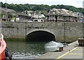
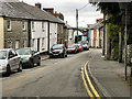
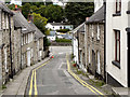
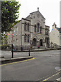
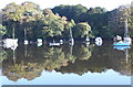
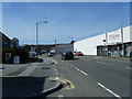
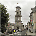
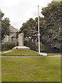
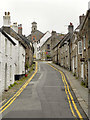
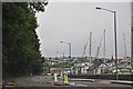
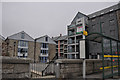
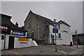
100 photos from this area
Area Information
Key information about the TR10 8JW including its size, population, and administrative classification.
- Area Type
- Postcode
- Area Size
- 2801 m²
- Population
- 2554
- Population Density
- 1525 people/km²
House Prices in TR10 8JW
23
Properties
£145,159
Average Sold Price
£13,500
Lowest Price
£310,000
Highest Price
Showing 23 properties
| Address | Type | Beds | Baths | Last Sale Price | Last Sale Date | |
|---|---|---|---|---|---|---|
| 57 St Thomas Street, Penryn, TR10 8JW | Terraced | 2 | 1 | £200,000 | May 2025 | |
| 48 St Thomas Street, Penryn, TR10 8JW | Terraced | 4 | 1 | £278,000 | Jul 2022 | |
| 38 St Thomas Street, Penryn, TR10 8JW | Terraced | 2 | 2 | £250,000 | Aug 2018 | |
| 42 St Thomas Street, Penryn, TR10 8JW | Terraced | 3 | - | £310,000 | Jul 2016 | |
| 54 St Thomas Street, Penryn, TR10 8JW | Cottage | 2 | 1 | £170,000 | May 2016 | |
| 59C St Thomas Street, Penryn, TR10 8JW | Flat | - | - | £120,000 | Oct 2014 | |
| 59B St Thomas Street, Penryn, TR10 8JW | Flat | - | - | £88,750 | Oct 2004 | |
| 44 St Thomas Street, Penryn, TR10 8JW | house | - | - | £48,500 | Jul 2001 | |
| 52 St Thomas Street, Penryn, TR10 8JW | Terraced | 2 | 1 | £56,000 | Dec 1999 | |
| 46 St Thomas Street, Penryn, TR10 8JW | Terraced | 2 | 1 | £62,000 | Dec 1999 |
Page 1 of 3
Energy Efficiency in TR10 8JW
Amenities
Schools
| Rank | School | Type | Entry gender | Ages |
|---|
Explore more schools in this area
Go to Schools tabDemographics
Household Size
Two person
most common
Accommodation Type
Houses
most common
Tenure
60
majority
Ethnic Group
White
most common
Religion
N/A
most common
Household Composition
N/A
most common
Age
47
median
Adults (30-64 years)
most common
Household Deprivation
N/A
with no deprivation
NS-SEC
33
in Lower managerial occupations
Explore more demographic insights in this area
Go to Demographics tabPlanning
Planning Constraints
- Flood RiskPremium
- Ramsar Wetland SitesPremium
- Area of Outstanding Natural BeautyPremium
- Protected Nature ReservePremium
- Protected WoodlandPremium