Area Overview for TA9 3LH
Photos of TA9 3LH
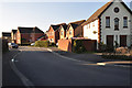
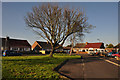
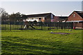
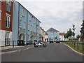
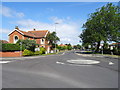
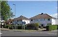
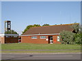
15 photos from this area
Area Information
Key information about the TA9 3LH including its size, population, and administrative classification.
- Area Type
- Postcode
- Area Size
- 7629 m²
- Population
- 2087
- Population Density
- 1563 people/km²
House Prices in TA9 3LH
21
Properties
£169,429
Average Sold Price
£79,000
Lowest Price
£302,000
Highest Price
Showing 21 properties
| Address | Type | Beds | Baths | Last Sale Price | Last Sale Date | |
|---|---|---|---|---|---|---|
| 8 Paddock Drive, Highbridge, TA9 3LH | Flat | - | - | £106,000 | Nov 2024 | |
| 18 Paddock Drive, Highbridge, TA9 3LH | Semi-detached | 4 | 2 | £294,500 | Jun 2023 | |
| 22 Paddock Drive, Highbridge, TA9 3LH | house | - | - | £225,500 | Aug 2022 | |
| 25 Paddock Drive, Highbridge, TA9 3LH | Bungalow | 2 | 1 | £302,000 | Aug 2022 | |
| 29 Paddock Drive, Highbridge, TA9 3LH | Semi-detached | 3 | - | £184,500 | Feb 2019 | |
| 36 Paddock Drive, Highbridge, TA9 3LH | house | - | - | £180,000 | Jun 2018 | |
| 24 Paddock Drive, Highbridge, TA9 3LH | house | - | - | £162,000 | Jun 2016 | |
| 14 Paddock Drive, Highbridge, TA9 3LH | Flat | - | - | £79,000 | Dec 2014 | |
| 28 Paddock Drive, Highbridge, TA9 3LH | house | 3 | - | £156,000 | May 2013 | |
| 32 Paddock Drive, Highbridge, TA9 3LH | house | 2 | - | £125,000 | Apr 2011 |
Page 1 of 3
Energy Efficiency in TA9 3LH
Amenities
Schools
| Rank | School | Type | Entry gender | Ages |
|---|
Explore more schools in this area
Go to Schools tabDemographics
Household Size
Two person
most common
Accommodation Type
Houses
most common
Tenure
65
majority
Ethnic Group
White
most common
Religion
N/A
most common
Household Composition
N/A
most common
Age
47
median
Adults (30-64 years)
most common
Household Deprivation
N/A
with no deprivation
NS-SEC
19
in Lower managerial occupations
Explore more demographic insights in this area
Go to Demographics tabPlanning
Planning Constraints
- Flood RiskPremium
- Ramsar Wetland SitesPremium
- Area of Outstanding Natural BeautyPremium
- Protected Nature ReservePremium
- Protected WoodlandPremium