Area Overview for TA8 2QU
Photos of TA8 2QU


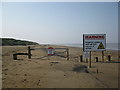


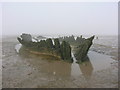
27 photos from this area
Area Information
Key information about the TA8 2QU including its size, population, and administrative classification.
- Area Type
- Postcode
- Area Size
- 2.1 km²
- Population
- 2250
- Population Density
- 155 people/km²
House Prices in TA8 2QU
49
Properties
£335,333
Average Sold Price
£89,000
Lowest Price
£795,000
Highest Price
Showing 49 properties
| Address | Type | Beds | Baths | Last Sale Price | Last Sale Date | |
|---|---|---|---|---|---|---|
| Avoca, Coast Road, Berrow, Burnham On Sea, TA8 2QU | Bungalow | 4 | 2 | £465,000 | Aug 2024 | |
| The Shrubbery, Coast Road, Berrow, Burnham On Sea, TA8 2QU | Detached | 3 | 2 | £435,000 | Sep 2021 | |
| Heron House, Coast Road, Berrow, Burnham On Sea, TA8 2QU | house | - | - | £795,000 | Aug 2021 | |
| Mount Pleasant Farm, Coast Road, Berrow, Burnham On Sea, TA8 2QU | Land | 2 | - | £410,000 | Feb 2020 | |
| 4 Shrubbery Close, Berrow, Burnham On Sea, TA8 2QU | Detached | 4 | 2 | £385,000 | Nov 2018 | |
| Sandpipers, Coast Road, Berrow, Burnham On Sea, TA8 2QU | Bungalow | 3 | - | £365,000 | Jun 2017 | |
| Pine Trees, Coast Road, Berrow, Burnham On Sea, TA8 2QU | Bungalow | 3 | - | £355,000 | Aug 2016 | |
| Thorney Pen, Coast Road, Berrow, Burnham On Sea, TA8 2QU | Detached | 4 | - | £480,000 | Dec 2014 | |
| El Ronda, Coast Road, Berrow, Burnham On Sea, TA8 2QU | house | - | - | £250,000 | Feb 2011 | |
| Roughlands, Coast Road, Berrow, Burnham On Sea, TA8 2QU | Bungalow | - | - | £340,000 | Sep 2010 |
Page 1 of 5
Energy Efficiency in TA8 2QU
Amenities
Schools
| Rank | School | Type | Entry gender | Ages |
|---|
Explore more schools in this area
Go to Schools tabDemographics
Household Size
Two person
most common
Accommodation Type
Houses
most common
Tenure
79
majority
Ethnic Group
White
most common
Religion
N/A
most common
Household Composition
N/A
most common
Age
47
median
Adults (30-64 years)
most common
Household Deprivation
N/A
with no deprivation
NS-SEC
25
in Lower managerial occupations
Explore more demographic insights in this area
Go to Demographics tabPlanning
Planning Constraints
- Flood RiskPremium
- Ramsar Wetland SitesPremium
- Area of Outstanding Natural BeautyPremium
- Protected Nature ReservePremium
- Protected WoodlandPremium