Area Overview for TA8 2QT
Photos of TA8 2QT
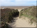
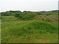
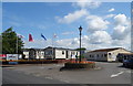
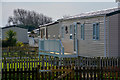
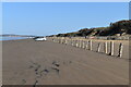


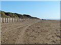
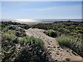
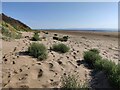
58 photos from this area
Area Information
Key information about the TA8 2QT including its size, population, and administrative classification.
- Area Type
- Postcode
- Area Size
- 36.1 hectares
- Population
- 2250
- Population Density
- 155 people/km²
House Prices in TA8 2QT
26
Properties
£388,750
Average Sold Price
£295,000
Lowest Price
£470,000
Highest Price
Showing 26 properties
| Address | Type | Beds | Baths | Last Sale Price | Last Sale Date | |
|---|---|---|---|---|---|---|
| Haven Vale, Hurn Lane, Berrow, Burnham On Sea, TA8 2QT | Bungalow | 4 | 3 | £470,000 | Nov 2022 | |
| Hurn Cottage, Hurn Lane, Berrow, Burnham On Sea, TA8 2QT | Bungalow | - | - | £375,000 | Feb 2019 | |
| Jesama, Hurn Lane, Berrow, Burnham On Sea, TA8 2QT | house | - | - | £415,000 | Aug 2018 | |
| Whitegates, Hurn Lane, Berrow, Burnham On Sea, TA8 2QT | Bungalow | 4 | 2 | £295,000 | Nov 2015 | |
| Flat 1, West Lodge, Hurn Lane, Berrow, Burnham On Sea, TA8 2QT | Flat | 2 | 1 | - | - | |
| Yew Tree House, Hurn Lane, Berrow, Burnham On Sea, TA8 2QT | Detached | 8 | 10 | - | - | |
| Driftwood House, Hurn Lane, Berrow, Burnham On Sea, TA8 2QT | Detached | 8 | 10 | - | - | |
| The Caravan, Hurn Farm, Hurn Lane, Berrow, Burnham On Sea, TA8 2QT | Mobile Home | - | - | - | - | |
| Heron Cottage, Hurn Lane, Berrow, Burnham On Sea, TA8 2QT | Bungalow | - | - | - | - | |
| Hurn Lane Caravan Club Site, Hurn Lane, Berrow, Burnham On Sea, TA8 2QT | shop | - | - | - | - |
Page 1 of 3
Energy Efficiency in TA8 2QT
Amenities
Schools
| Rank | School | Type | Entry gender | Ages |
|---|
Explore more schools in this area
Go to Schools tabDemographics
Household Size
Two person
most common
Accommodation Type
Houses
most common
Tenure
79
majority
Ethnic Group
White
most common
Religion
N/A
most common
Household Composition
N/A
most common
Age
47
median
Adults (30-64 years)
most common
Household Deprivation
N/A
with no deprivation
NS-SEC
25
in Lower managerial occupations
Explore more demographic insights in this area
Go to Demographics tabPlanning
Planning Constraints
- Flood RiskPremium
- Ramsar Wetland SitesPremium
- Area of Outstanding Natural BeautyPremium
- Protected Nature ReservePremium
- Protected WoodlandPremium