Area Overview for TA8 2DD
Photos of TA8 2DD
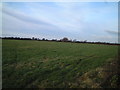
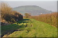
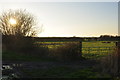
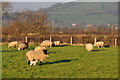
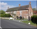
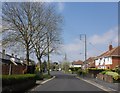
10 photos from this area
Area Information
Key information about the TA8 2DD including its size, population, and administrative classification.
- Area Type
- Postcode
- Area Size
- 3.0 hectares
- Population
- 1579
- Population Density
- 1456 people/km²
House Prices in TA8 2DD
48
Properties
£248,943
Average Sold Price
£47,000
Lowest Price
£490,000
Highest Price
Showing 48 properties
| Address | Type | Beds | Baths | Last Sale Price | Last Sale Date | |
|---|---|---|---|---|---|---|
| 111 Stoddens Road, Burnham On Sea, TA8 2DD | Bungalow | 3 | 2 | £370,000 | May 2025 | |
| 150 Stoddens Road, Burnham On Sea, TA8 2DD | Detached | 3 | 2 | £335,000 | Jan 2024 | |
| 142 Stoddens Road, Burnham On Sea, TA8 2DD | Detached | 4 | 2 | £490,000 | Dec 2023 | |
| 115 Stoddens Road, Burnham On Sea, TA8 2DD | Semi-detached | 3 | 2 | £320,000 | Jun 2023 | |
| 92 Stoddens Road, Burnham On Sea, TA8 2DD | Terraced | 4 | 2 | £310,000 | May 2023 | |
| 100 Stoddens Road, Burnham On Sea, TA8 2DD | house | - | - | £330,000 | Mar 2022 | |
| 105 Stoddens Road, Burnham On Sea, TA8 2DD | house | 3 | 1 | £450,000 | Feb 2022 | |
| 98 Stoddens Road, Burnham On Sea, TA8 2DD | house | - | - | £295,000 | Nov 2021 | |
| 94 Stoddens Road, Burnham On Sea, TA8 2DD | house | - | - | £284,000 | Jul 2021 | |
| 117 Stoddens Road, Burnham On Sea, TA8 2DD | Detached | 3 | 1 | £385,000 | Jun 2021 |
Page 1 of 5
Energy Efficiency in TA8 2DD
Amenities
Schools
| Rank | School | Type | Entry gender | Ages |
|---|
Explore more schools in this area
Go to Schools tabDemographics
Household Size
Two person
most common
Accommodation Type
Houses
most common
Tenure
88
majority
Ethnic Group
White
most common
Religion
N/A
most common
Household Composition
N/A
most common
Age
47
median
Adults (30-64 years)
most common
Household Deprivation
N/A
with no deprivation
NS-SEC
35
in Lower managerial occupations
Explore more demographic insights in this area
Go to Demographics tabPlanning
Planning Constraints
- Flood RiskPremium
- Ramsar Wetland SitesPremium
- Area of Outstanding Natural BeautyPremium
- Protected Nature ReservePremium
- Protected WoodlandPremium