Area Overview for TA6 7EH
Photos of TA6 7EH
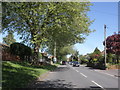
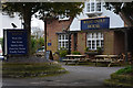
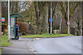
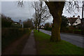

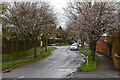
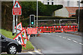
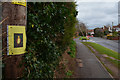
28 photos from this area
Area Information
Key information about the TA6 7EH including its size, population, and administrative classification.
- Area Type
- Postcode
- Area Size
- 1.1 hectares
- Population
- 2000
- Population Density
- 2789 people/km²
House Prices in TA6 7EH
15
Properties
£200,612
Average Sold Price
£55,000
Lowest Price
£295,050
Highest Price
Showing 15 properties
| Address | Type | Beds | Baths | Last Sale Price | Last Sale Date | |
|---|---|---|---|---|---|---|
| 47 Quantock Road, Bridgwater, TA6 7EH | Semi-detached | 3 | 1 | £295,050 | Dec 2017 | |
| 53 Quantock Road, Bridgwater, TA6 7EH | Semi-detached | 4 | - | £269,000 | May 2017 | |
| 51 Quantock Road, Bridgwater, TA6 7EH | Semi-detached | 3 | - | £205,000 | Jan 2017 | |
| 49 Quantock Road, Bridgwater, TA6 7EH | house | - | - | £232,000 | Nov 2011 | |
| 38 Quantock Road, Bridgwater, TA6 7EH | house | 3 | - | £224,000 | Oct 2011 | |
| 39 Quantock Road, Bridgwater, TA6 7EH | house | - | - | £249,950 | Apr 2010 | |
| 36 Quantock Road, Bridgwater, TA6 7EH | house | - | - | £154,000 | Jun 2009 | |
| 41 Quantock Road, Bridgwater, TA6 7EH | Detached | - | - | £250,000 | Mar 2008 | |
| 43 Quantock Road, Bridgwater, TA6 7EH | Semi-detached | - | - | £245,000 | Mar 2007 | |
| 40 Quantock Road, Bridgwater, TA6 7EH | Semi-detached | - | - | £183,500 | May 2003 |
Page 1 of 2
Energy Efficiency in TA6 7EH
Amenities
Schools
| Rank | School | Type | Entry gender | Ages |
|---|
Explore more schools in this area
Go to Schools tabDemographics
Household Size
Family (3-5 people)
most common
Accommodation Type
Houses
most common
Tenure
85
majority
Ethnic Group
White
most common
Religion
N/A
most common
Household Composition
N/A
most common
Age
47
median
Adults (30-64 years)
most common
Household Deprivation
N/A
with no deprivation
NS-SEC
35
in Lower managerial occupations
Explore more demographic insights in this area
Go to Demographics tabPlanning
Planning Constraints
- Flood RiskPremium
- Ramsar Wetland SitesPremium
- Area of Outstanding Natural BeautyPremium
- Protected Nature ReservePremium
- Protected WoodlandPremium