Area Overview for TA5 1ST
Photos of TA5 1ST
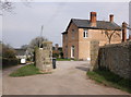

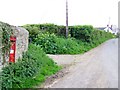
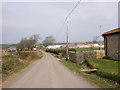
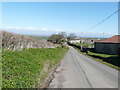
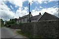
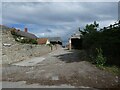
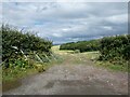
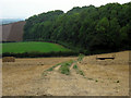


16 photos from this area
Area Information
Key information about the TA5 1ST including its size, population, and administrative classification.
- Area Type
- Postcode
- Area Size
- 1.8 km²
- Population
- 2145
- Population Density
- 42 people/km²
House Prices in TA5 1ST
18
Properties
£271,000
Average Sold Price
£57,500
Lowest Price
£560,000
Highest Price
Showing 18 properties
| Address | Type | Beds | Baths | Last Sale Price | Last Sale Date | |
|---|---|---|---|---|---|---|
| Keepers Cottage, Kilton Road, Kilve, Nether Stowey, TA5 1ST | Detached | 3 | 2 | £560,000 | Sep 2025 | |
| Steepholme, 1 Kilton Road, Kilve, Nether Stowey, TA5 1ST | Detached | 3 | 1 | £467,500 | Jan 2024 | |
| Rose Cottage, 7 Kilton Farm Lane, Stringston, Nether Stowey, TA5 1ST | Detached | - | - | £175,000 | May 2021 | |
| 10 Kilton Farm Lane, Stringston, Nether Stowey, TA5 1ST | Terraced | 2 | 1 | £95,000 | Nov 2003 | |
| 11 Kilton Farm Lane, Stringston, Nether Stowey, TA5 1ST | house | - | - | £57,500 | Jun 1996 | |
| 9 Kilton Farm Lane, Stringston, Nether Stowey, TA5 1ST | Terraced | 2 | 1 | - | - | |
| Kilton Farm East, 5 Kilton Road, Kilve, Nether Stowey, TA5 1ST | Detached | 4 | 2 | - | - | |
| 3, East Kilton Farm Cottages, Kilton Road, Kilve, Nether Stowey, TA5 1ST | Land | - | - | - | - | |
| 1 Kilton Road, Kilve, Nether Stowey, TA5 1ST | Semi-detached | 3 | 1 | - | - | |
| Kilton Farm West, 4 Kilton Road, Kilve, Nether Stowey, TA5 1ST | Detached | - | - | - | - |
Page 1 of 2
Energy Efficiency in TA5 1ST
Amenities
Schools
| Rank | School | Type | Entry gender | Ages |
|---|
Explore more schools in this area
Go to Schools tabDemographics
Household Size
Two person
most common
Accommodation Type
Houses
most common
Tenure
68
majority
Ethnic Group
White
most common
Religion
N/A
most common
Household Composition
N/A
most common
Age
47
median
Adults (30-64 years)
most common
Household Deprivation
N/A
with no deprivation
NS-SEC
31
in Lower managerial occupations
Explore more demographic insights in this area
Go to Demographics tabPlanning
Planning Constraints
- Flood RiskPremium
- Ramsar Wetland SitesPremium
- Area of Outstanding Natural BeautyPremium
- Protected Nature ReservePremium
- Protected WoodlandPremium