Area Overview for TA5 1EG
Photos of TA5 1EG


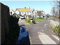

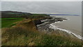

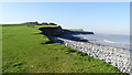
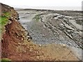

98 photos from this area
Area Information
Key information about the TA5 1EG including its size, population, and administrative classification.
- Area Type
- Postcode
- Area Size
- 2.0 km²
- Population
- 2145
- Population Density
- 42 people/km²
House Prices in TA5 1EG
17
Properties
£446,833
Average Sold Price
£193,000
Lowest Price
£875,000
Highest Price
Showing 17 properties
| Address | Type | Beds | Baths | Last Sale Price | Last Sale Date | |
|---|---|---|---|---|---|---|
| Badgenben Lodge, Sea Lane, Kilve, Nether Stowey, TA5 1EG | house | - | - | £560,000 | Nov 2024 | |
| 2, The Old Thatch, Sea Lane, Kilve, Nether Stowey, TA5 1EG | Semi-detached | 3 | 1 | £243,000 | Jul 2021 | |
| Jamara, Sea Lane, Kilve, Nether Stowey, TA5 1EG | Detached | 3 | - | £875,000 | Jun 2021 | |
| Church Cottage South, Sea Lane, Kilve, Nether Stowey, TA5 1EG | house | - | - | £370,000 | May 2015 | |
| Parkhouse Cottage, Sea Lane, Kilve, Nether Stowey, TA5 1EG | Detached | 3 | - | £193,000 | Oct 1999 | |
| Old Rectory House, Sea Lane, Kilve, Nether Stowey, TA5 1EG | Detached | - | - | £440,000 | Sep 1998 | |
| Church Cottage North, Sea Lane, Kilve, Nether Stowey, TA5 1EG | Semi-detached | 4 | 2 | - | - | |
| The Gig House, Sea Lane, Kilve, Nether Stowey, TA5 1EG | Bungalow | - | - | - | - | |
| Park House, Sea Lane, Kilve, Nether Stowey, TA5 1EG | house | - | - | - | - | |
| Old Rectory Cottage, Sea Lane, Kilve, Nether Stowey, TA5 1EG | Detached | - | - | - | - |
Page 1 of 2
Energy Efficiency in TA5 1EG
Amenities
Schools
| Rank | School | Type | Entry gender | Ages |
|---|
Explore more schools in this area
Go to Schools tabDemographics
Household Size
Two person
most common
Accommodation Type
Houses
most common
Tenure
68
majority
Ethnic Group
White
most common
Religion
N/A
most common
Household Composition
N/A
most common
Age
47
median
Adults (30-64 years)
most common
Household Deprivation
N/A
with no deprivation
NS-SEC
31
in Lower managerial occupations
Explore more demographic insights in this area
Go to Demographics tabPlanning
Planning Constraints
- Flood RiskPremium
- Ramsar Wetland SitesPremium
- Area of Outstanding Natural BeautyPremium
- Protected Nature ReservePremium
- Protected WoodlandPremium