Area Overview for TA19 0SB
Photos of TA19 0SB
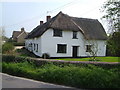
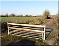
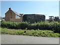
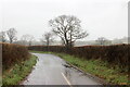


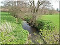

9 photos from this area
Area Information
Key information about the TA19 0SB including its size, population, and administrative classification.
- Area Type
- Postcode
- Area Size
- 87.3 hectares
- Population
- 1280
- Population Density
- 114 people/km²
House Prices in TA19 0SB
26
Properties
£508,571
Average Sold Price
£440,000
Lowest Price
£600,000
Highest Price
Showing 26 properties
| Address | Type | Beds | Baths | Last Sale Price | Last Sale Date | |
|---|---|---|---|---|---|---|
| Meadowsmeet, Old A 3037, Sea, Ilminster, TA19 0SB | Semi-detached | - | - | £600,000 | Dec 2024 | |
| Dilwyn, Old A 3037, Sea, Ilminster, TA19 0SB | Semi-detached | 3 | - | £440,000 | Feb 2021 | |
| Barnhaven, Old A 3037, Sea, Ilminster, TA19 0SB | Detached | - | - | £590,000 | Mar 2020 | |
| Meadow View, Old A 3037, Sea, Ilminster, TA19 0SB | Semi-detached | - | - | £500,000 | Oct 2019 | |
| Springfield, Old A 3037, Sea, Ilminster, TA19 0SB | Semi-detached | - | - | £500,000 | Aug 2019 | |
| Higher Sea House, Old A 3037, Sea, Ilminster, TA19 0SB | house | 4 | - | £465,000 | Jun 2014 | |
| Longcroft, Old A 3037, Sea, Ilminster, TA19 0SB | Detached | 5 | 2 | £465,000 | Mar 2014 | |
| Green Meadows, Old A 3037, Sea, Ilminster, TA19 0SB | Detached | 4 | 2 | - | - | |
| Pippinsfield, Old A 3037, Sea, Ilminster, TA19 0SB | Equestrian | 4 | 2 | - | - | |
| Granary House, Sea Farm, Old A 3037, Sea, Ilminster, TA19 0SB | Semi-detached | 5 | 1 | - | - |
Page 1 of 3
Energy Efficiency in TA19 0SB
Amenities
Schools
| Rank | School | Type | Entry gender | Ages |
|---|
Explore more schools in this area
Go to Schools tabDemographics
Household Size
Two person
most common
Accommodation Type
Houses
most common
Tenure
78
majority
Ethnic Group
White
most common
Religion
N/A
most common
Household Composition
N/A
most common
Age
47
median
Adults (30-64 years)
most common
Household Deprivation
N/A
with no deprivation
NS-SEC
34
in Lower managerial occupations
Explore more demographic insights in this area
Go to Demographics tabPlanning
Planning Constraints
- Flood RiskPremium
- Ramsar Wetland SitesPremium
- Area of Outstanding Natural BeautyPremium
- Protected Nature ReservePremium
- Protected WoodlandPremium