Area Overview for TA19 0PP
Photos of TA19 0PP

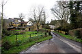
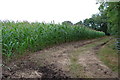
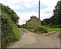
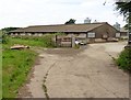


13 photos from this area
Area Information
Key information about the TA19 0PP including its size, population, and administrative classification.
- Area Type
- Postcode
- Area Size
- 92.8 hectares
- Population
- 2344
- Population Density
- 38 people/km²
House Prices in TA19 0PP
14
Properties
£359,900
Average Sold Price
£5,000
Lowest Price
£795,000
Highest Price
Showing 14 properties
| Address | Type | Beds | Baths | Last Sale Price | Last Sale Date | |
|---|---|---|---|---|---|---|
| Oxenford Farm House, Oxenford Lane, Dowlish Wake, Ilminster, TA19 0PP | house | - | - | £5,000 | May 2022 | |
| Oak Tree Cottage, Oxenford Lane, Dowlish Wake, Ilminster, TA19 0PP | house | - | - | £299,000 | Feb 2021 | |
| The Wagon House, Oxenford Lane, Dowlish Wake, Ilminster, TA19 0PP | house | 5 | - | £795,000 | May 2017 | |
| Kitchells, Kitchill Lane South, Dowlish Wake, Ilminster, TA19 0PP | Detached | 4 | 3 | £415,500 | Apr 2008 | |
| Meades End, Oxenford Lane, Dowlish Wake, Ilminster, TA19 0PP | Detached | - | - | £285,000 | May 2002 | |
| Oxenford Farm, Oxenford Lane, Dowlish Wake, Ilminster, TA19 0PP | house | 4 | 1 | - | - | |
| Oxenford Farm Cottage, Oxenford Lane, Dowlish Wake, Ilminster, TA19 0PP | Semi-detached | 3 | - | - | - | |
| Oxenford Farm Yurts, Oxenford Lane, Dowlish Wake, Ilminster, TA19 0PP | hotel | - | - | - | - | |
| Oxenford Fruit Farm, Kitchill Lane South, Dowlish Wake, Ilminster, TA19 0PP | Detached | - | - | - | - | |
| Oak House, Oxenford Lane, Dowlish Wake, Ilminster, TA19 0PP | Detached | - | - | - | - |
Page 1 of 2
Energy Efficiency in TA19 0PP
Amenities
Schools
| Rank | School | Type | Entry gender | Ages |
|---|
Explore more schools in this area
Go to Schools tabDemographics
Household Size
Two person
most common
Accommodation Type
Houses
most common
Tenure
77
majority
Ethnic Group
White
most common
Religion
N/A
most common
Household Composition
N/A
most common
Age
47
median
Adults (30-64 years)
most common
Household Deprivation
N/A
with no deprivation
NS-SEC
37
in Lower managerial occupations
Explore more demographic insights in this area
Go to Demographics tabPlanning
Planning Constraints
- Flood RiskPremium
- Ramsar Wetland SitesPremium
- Area of Outstanding Natural BeautyPremium
- Protected Nature ReservePremium
- Protected WoodlandPremium