Area Overview for TA18 8BP
Photos of TA18 8BP
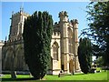
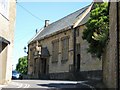
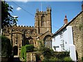
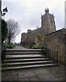
76 photos from this area
Area Information
Key information about the TA18 8BP including its size, population, and administrative classification.
- Area Type
- Postcode
- Area Size
- 1.7 hectares
- Population
- 1671
- Population Density
- 1068 people/km²
House Prices in TA18 8BP
36
Properties
£172,195
Average Sold Price
£50,000
Lowest Price
£430,000
Highest Price
Showing 36 properties
| Address | Type | Beds | Baths | Last Sale Price | Last Sale Date | |
|---|---|---|---|---|---|---|
| Culverkeys, Barn Street, Crewkerne, TA18 8BP | Bungalow | 2 | 2 | £310,000 | Mar 2025 | |
| Tithe Barn House, Barn Street, Crewkerne, TA18 8BP | Terraced | 4 | 2 | £430,000 | Jul 2024 | |
| 29 Barn Street, Crewkerne, TA18 8BP | house | - | - | £130,000 | Feb 2024 | |
| 9 Barn Street, Crewkerne, TA18 8BP | Cottage | 2 | 1 | £194,000 | Jul 2023 | |
| 13 Barn Street, Crewkerne, TA18 8BP | Terraced | 2 | 1 | £125,000 | Aug 2021 | |
| 43 Barn Street, Crewkerne, TA18 8BP | Terraced | 2 | 1 | £172,500 | Feb 2018 | |
| 41 Barn Street, Crewkerne, TA18 8BP | Terraced | 3 | 1 | £157,000 | Mar 2017 | |
| 51 Barn Street, Crewkerne, TA18 8BP | Terraced | 3 | - | £175,000 | May 2016 | |
| 47 Barn Street, Crewkerne, TA18 8BP | Terraced | 2 | 1 | £135,000 | Feb 2016 | |
| Glenan, Barn Street, Crewkerne, TA18 8BP | Bungalow | 3 | 2 | £356,000 | Jun 2015 |
Page 1 of 4
Energy Efficiency in TA18 8BP
Amenities
Schools
| Rank | School | Type | Entry gender | Ages |
|---|
Explore more schools in this area
Go to Schools tabDemographics
Household Size
One person
most common
Accommodation Type
Houses
most common
Tenure
66
majority
Ethnic Group
White
most common
Religion
N/A
most common
Household Composition
N/A
most common
Age
47
median
Adults (30-64 years)
most common
Household Deprivation
N/A
with no deprivation
NS-SEC
33
in Lower managerial occupations
Explore more demographic insights in this area
Go to Demographics tabPlanning
Planning Constraints
- Flood RiskPremium
- Ramsar Wetland SitesPremium
- Area of Outstanding Natural BeautyPremium
- Protected Nature ReservePremium
- Protected WoodlandPremium