Area Overview for TA13 5DJ
Photos of TA13 5DJ
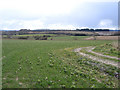
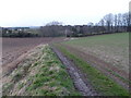
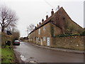
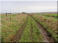
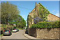
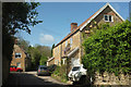
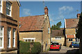
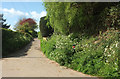
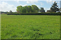
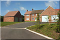

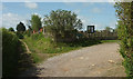
34 photos from this area
Area Information
Key information about the TA13 5DJ including its size, population, and administrative classification.
- Area Type
- Postcode
- Area Size
- 74.8 hectares
- Population
- 1598
- Population Density
- 141 people/km²
House Prices in TA13 5DJ
50
Properties
£215,259
Average Sold Price
£39,000
Lowest Price
£450,000
Highest Price
Showing 50 properties
| Address | Type | Beds | Baths | Last Sale Price | Last Sale Date | |
|---|---|---|---|---|---|---|
| 70 West Street, South Petherton, TA13 5DJ | Terraced | 2 | 1 | £265,000 | Oct 2025 | |
| Little Gables, West Street, South Petherton, TA13 5DJ | Bungalow | - | - | £430,000 | Jan 2024 | |
| 68 West Street, South Petherton, TA13 5DJ | Terraced | 1 | 1 | £202,000 | Jun 2022 | |
| 52 West Street, South Petherton, TA13 5DJ | Terraced | 3 | 1 | £220,000 | Dec 2021 | |
| 76 West Street, South Petherton, TA13 5DJ | Cottage | 2 | 1 | £240,000 | Nov 2021 | |
| 66 West Street, South Petherton, TA13 5DJ | Cottage | 2 | 1 | £186,000 | Jun 2021 | |
| Fesant, West Street, South Petherton, TA13 5DJ | Bungalow | 4 | 2 | £440,000 | May 2021 | |
| 60 West Street, South Petherton, TA13 5DJ | Cottage | 2 | 1 | £143,000 | Mar 2021 | |
| 50 West Street, South Petherton, TA13 5DJ | Cottage | 3 | 2 | £201,000 | Jul 2019 | |
| 40 West Street, South Petherton, TA13 5DJ | Terraced | 2 | 1 | £170,000 | Apr 2019 |
Page 1 of 5
Energy Efficiency in TA13 5DJ
Amenities
Schools
| Rank | School | Type | Entry gender | Ages |
|---|
Explore more schools in this area
Go to Schools tabDemographics
Household Size
Two person
most common
Accommodation Type
Houses
most common
Tenure
82
majority
Ethnic Group
White
most common
Religion
N/A
most common
Household Composition
N/A
most common
Age
47
median
Adults (30-64 years)
most common
Household Deprivation
N/A
with no deprivation
NS-SEC
40
in Lower managerial occupations
Explore more demographic insights in this area
Go to Demographics tabPlanning
Planning Constraints
- Flood RiskPremium
- Ramsar Wetland SitesPremium
- Area of Outstanding Natural BeautyPremium
- Protected Nature ReservePremium
- Protected WoodlandPremium