Area Overview for SP9 7XN
Photos of SP9 7XN
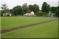
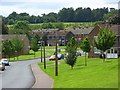
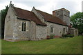
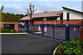
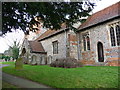
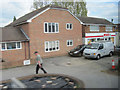
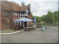
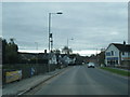
18 photos from this area
Area Information
Key information about the SP9 7XN including its size, population, and administrative classification.
- Area Type
- Postcode
- Area Size
- 8526 m²
- Population
- 1824
- Population Density
- 742 people/km²
House Prices in SP9 7XN
32
Properties
£181,354
Average Sold Price
£75,000
Lowest Price
£322,995
Highest Price
Showing 32 properties
| Address | Type | Beds | Baths | Last Sale Price | Last Sale Date | |
|---|---|---|---|---|---|---|
| 31 Symons Close, Tidworth, SP9 7XN | Flat | - | - | £185,000 | Jun 2025 | |
| 1 Symons Close, Tidworth, SP9 7XN | house | 3 | 2 | £265,000 | Nov 2024 | |
| 17 Symons Close, Tidworth, SP9 7XN | Flat | 2 | 2 | £165,000 | May 2022 | |
| 33 Symons Close, Tidworth, SP9 7XN | Flat | - | - | £154,995 | Jul 2020 | |
| 23 Symons Close, Tidworth, SP9 7XN | Flat | - | - | £150,000 | Jul 2020 | |
| 21 Symons Close, Tidworth, SP9 7XN | Flat | 2 | 2 | £145,000 | Jul 2020 | |
| 39 Symons Close, Tidworth, SP9 7XN | Flat | - | - | £149,995 | Jan 2020 | |
| 37 Symons Close, Tidworth, SP9 7XN | Flat | 2 | 2 | £152,995 | Dec 2019 | |
| 25 Symons Close, Tidworth, SP9 7XN | Flat | 2 | 2 | £167,995 | Dec 2019 | |
| 35 Symons Close, Tidworth, SP9 7XN | Flat | - | - | £149,995 | Dec 2019 |
Page 1 of 4
Energy Efficiency in SP9 7XN
Amenities
Schools
| Rank | School | Type | Entry gender | Ages |
|---|
Explore more schools in this area
Go to Schools tabDemographics
Household Size
Family (3-5 people)
most common
Accommodation Type
Houses
most common
Tenure
50
majority
Ethnic Group
White
most common
Religion
N/A
most common
Household Composition
N/A
most common
Age
22
median
Adults (30-64 years)
most common
Household Deprivation
N/A
with no deprivation
NS-SEC
34
in Lower managerial occupations
Explore more demographic insights in this area
Go to Demographics tabPlanning
Planning Constraints
- Flood RiskPremium
- Ramsar Wetland SitesPremium
- Area of Outstanding Natural BeautyPremium
- Protected Nature ReservePremium
- Protected WoodlandPremium