Area Overview for SP9 7WU
Photos of SP9 7WU
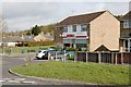
5 photos from this area
Area Information
Key information about the SP9 7WU including its size, population, and administrative classification.
- Area Type
- Postcode
- Area Size
- 2.2 hectares
- Population
- 1824
- Population Density
- 742 people/km²
House Prices in SP9 7WU
68
Properties
£227,168
Average Sold Price
£130,000
Lowest Price
£294,995
Highest Price
Showing 68 properties
| Address | Type | Beds | Baths | Last Sale Price | Last Sale Date | |
|---|---|---|---|---|---|---|
| 1 Eyles Road, Tidworth, SP9 7WU | house | - | - | £219,950 | Sep 2024 | |
| 12 Eyles Road, Tidworth, SP9 7WU | Semi-detached | 3 | 2 | £280,000 | Sep 2023 | |
| 3 Eyles Road, Tidworth, SP9 7WU | house | - | - | £190,000 | Nov 2021 | |
| 65 Eyles Road, Tidworth, SP9 7WU | house | - | - | £190,000 | Apr 2021 | |
| 43 Eyles Road, Tidworth, SP9 7WU | Detached | 3 | 2 | £291,495 | Feb 2021 | |
| 27 Eyles Road, Tidworth, SP9 7WU | house | - | - | £234,995 | Dec 2020 | |
| 20 Eyles Road, Tidworth, SP9 7WU | house | - | - | £234,900 | Aug 2020 | |
| 18 Eyles Road, Tidworth, SP9 7WU | house | - | - | £234,995 | Aug 2020 | |
| 59 Eyles Road, Tidworth, SP9 7WU | house | - | - | £287,995 | Jul 2020 | |
| 45 Eyles Road, Tidworth, SP9 7WU | house | - | - | £294,995 | Jun 2020 |
Page 1 of 7
Energy Efficiency in SP9 7WU
Amenities
Schools
| Rank | School | Type | Entry gender | Ages |
|---|
Explore more schools in this area
Go to Schools tabDemographics
Household Size
Family (3-5 people)
most common
Accommodation Type
Houses
most common
Tenure
50
majority
Ethnic Group
White
most common
Religion
N/A
most common
Household Composition
N/A
most common
Age
22
median
Adults (30-64 years)
most common
Household Deprivation
N/A
with no deprivation
NS-SEC
34
in Lower managerial occupations
Explore more demographic insights in this area
Go to Demographics tabPlanning
Planning Constraints
- Flood RiskPremium
- Ramsar Wetland SitesPremium
- Area of Outstanding Natural BeautyPremium
- Protected Nature ReservePremium
- Protected WoodlandPremium