Area Overview for SP5 2BG
Photos of SP5 2BG

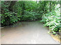

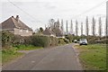

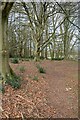
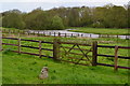

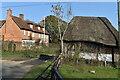

37 photos from this area
Area Information
Key information about the SP5 2BG including its size, population, and administrative classification.
- Area Type
- Postcode
- Area Size
- 53.9 hectares
- Population
- 1862
- Population Density
- 149 people/km²
House Prices in SP5 2BG
16
Properties
£995,000
Average Sold Price
£485,000
Lowest Price
£1,400,000
Highest Price
Showing 16 properties
| Address | Type | Beds | Baths | Last Sale Price | Last Sale Date | |
|---|---|---|---|---|---|---|
| Sandyrood, Giles Lane, Landford, SP5 2BG | Bungalow | 3 | 1 | £485,000 | Sep 2025 | |
| Ten Acres, Giles Lane, Landford, SP5 2BG | Bungalow | 6 | - | £1,100,000 | Mar 2023 | |
| Nelson Farm, Giles Lane, Landford, SP5 2BG | house | - | - | £1,400,000 | Oct 2019 | |
| Beaumont Water Heaters, Giles Lane, Landford, SP5 2BG | Industrial | - | - | - | - | |
| Amplespace Storage, Giles Lane, Landford, SP5 2BG | warehouse | - | - | - | - | |
| The Mobile Home, Ten Acres, Giles Lane, Landford, SP5 2BG | Mobile Home | - | - | - | - | |
| Plot 33, Giles Lane Industrial Estate, Giles Lane, Landford, SP5 2BG | Industrial | - | - | - | - | |
| Plot 39, Giles Lane Industrial Estate, Giles Lane, Landford, SP5 2BG | Industrial | - | - | - | - | |
| Plots 7, Giles Lane Industrial Estate, Giles Lane, Landford, SP5 2BG | Industrial | - | - | - | - | |
| Plots 24 - 26, Giles Lane Industrial Estate, Giles Lane, Landford, SP5 2BG | Industrial | - | - | - | - |
Page 1 of 2
Energy Efficiency in SP5 2BG
Amenities
Schools
| Rank | School | Type | Entry gender | Ages |
|---|
Explore more schools in this area
Go to Schools tabDemographics
Household Size
Two person
most common
Accommodation Type
Houses
most common
Tenure
88
majority
Ethnic Group
White
most common
Religion
N/A
most common
Household Composition
N/A
most common
Age
47
median
Adults (30-64 years)
most common
Household Deprivation
N/A
with no deprivation
NS-SEC
46
in Lower managerial occupations
Explore more demographic insights in this area
Go to Demographics tabPlanning
Planning Constraints
- Flood RiskPremium
- Ramsar Wetland SitesPremium
- Area of Outstanding Natural BeautyPremium
- Protected Nature ReservePremium
- Protected WoodlandPremium